IMAGES TAKEN NEAR TO
Burchetts Green Road, MAIDENHEAD, SL6 6QR
Introduction
This page details the photographs taken nearby to Burchetts Green Road, SL6 6QR by members of the Geograph project.
The Geograph project started in 2005 with the aim of publishing, organising and preserving representative images for every square kilometre of Great Britain, Ireland and the Isle of Man.

There are currently over 7.5m images from over14,400 individuals and you can help contribute to the project by visiting https://www.geograph.org.uk
Image Map
Images are licensed for reuse under creativecommons.org/licenses/by-sa/2.0
Notes
- Clicking on the map will re-center to the selected point.
- The higher the marker number, the further away the image location is from the centre of the postcode.
Image Listing (8 Images Found)
Images are licensed for reuse under creativecommons.org/licenses/by-sa/2.0
Image
Details
Distance
1
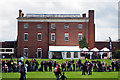
Hall Place, Berkshire College of Agriculture
Front view Image
Grade I listed.
Image: © Oast House Archive
Taken: 25 Apr 2009
0.01 miles
2
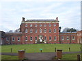
Hall Place, Berkshire College of Agriculture
Image: © Andrew Smith
Taken: 24 Dec 2005
0.06 miles
3
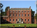
Hall Place (Berkshire College of Agriculture)
Image: © Mark Percy
Taken: 16 Oct 2010
0.06 miles
4
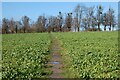
Farmland, Hurley
A footpath from Burchett's Green heading through turnips on its way to the avenue of lime trees on the drive to Hall Place.
Image: © Andrew Smith
Taken: 15 Nov 2020
0.11 miles
5
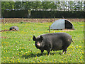
Pigs at Berkshire College of Agriculture
Image: © Oast House Archive
Taken: 25 Apr 2009
0.19 miles
6
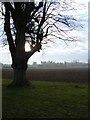
Farmland at Berkshire College of Agriculture
Image: © Andrew Smith
Taken: 24 Dec 2005
0.19 miles
7
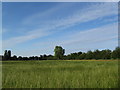
Ryegrass field at Hall Place
Looking towards the sports fields from a footpath off the main drive. This is a field of ryegrass ready to cut to provide winter feed for the many horses kept at the BCA.
Image: © Catriona Lambeth
Taken: 5 Jul 2011
0.20 miles
8
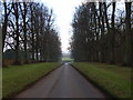
The driveway, Berkshire College of Agriculture
Image: © Andrew Smith
Taken: 24 Dec 2005
0.22 miles