IMAGES TAKEN NEAR TO
Choke Lane, MAIDENHEAD, SL6 6PT
Introduction
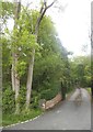
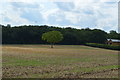
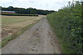
This page details the photographs taken nearby to Choke Lane, SL6 6PT by members of the Geograph project.
The Geograph project started in 2005 with the aim of publishing, organising and preserving representative images for every square kilometre of Great Britain, Ireland and the Isle of Man.

There are currently over 7.5m images from over14,400 individuals and you can help contribute to the project by visiting https://www.geograph.org.uk
Image Map (35 Images)


Leaflet Map data © OpenStreetMap
Images are licensed for reuse under creativecommons.org/licenses/by-sa/2.0
Notes
- Clicking on the map will re-center to the selected point.
- The higher the marker number, the further away the image location is from the centre of the postcode.
Image Listing (35 Images Found)
Images are licensed for reuse under creativecommons.org/licenses/by-sa/2.0
Image
Details
Distance
9
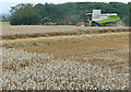
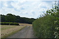
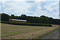
Starting to harvest
This Claas combine harvester had just been started up and was just setting off on its first cut along the far edge of the field.
Image: © Graham Horn
Taken: 6 Aug 2011
0.11 miles