IMAGES TAKEN NEAR TO
Winston Court, Halifax Road, MAIDENHEAD, SL6 5HU
Introduction
This page details the photographs taken nearby to Winston Court, Halifax Road, SL6 5HU by members of the Geograph project.
The Geograph project started in 2005 with the aim of publishing, organising and preserving representative images for every square kilometre of Great Britain, Ireland and the Isle of Man.

There are currently over 7.5m images from over14,400 individuals and you can help contribute to the project by visiting https://www.geograph.org.uk
Image Map
Images are licensed for reuse under creativecommons.org/licenses/by-sa/2.0
Notes
- Clicking on the map will re-center to the selected point.
- The higher the marker number, the further away the image location is from the centre of the postcode.
Image Listing (8 Images Found)
Images are licensed for reuse under creativecommons.org/licenses/by-sa/2.0
Image
Details
Distance
2

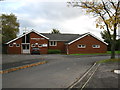
The Waggon and Horses
A pub on the edge of town on Pinkneys Road.
Image: © Des Blenkinsopp
Taken: 14 Apr 2014
0.17 miles

4
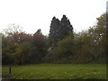
Cranbrook Drive public footpath
The remains of a public footpath that once crossed open farmland.
Image: © don cload
Taken: 1 Nov 2012
0.21 miles
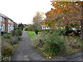
5
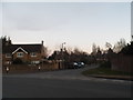
Knowsley Close at the junction of Furze Platt Road
Image: © David Howard
Taken: 20 Mar 2016
0.22 miles
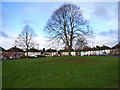
6
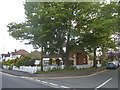
Greenways Drive at the junction of Pinkneys Road
Image: © David Howard
Taken: 15 May 2016
0.24 miles