IMAGES TAKEN NEAR TO
Bath Road, MAIDENHEAD, SL6 3RX
Introduction
This page details the photographs taken nearby to Bath Road, SL6 3RX by members of the Geograph project.
The Geograph project started in 2005 with the aim of publishing, organising and preserving representative images for every square kilometre of Great Britain, Ireland and the Isle of Man.

There are currently over 7.5m images from over14,400 individuals and you can help contribute to the project by visiting https://www.geograph.org.uk
Image Map
Images are licensed for reuse under creativecommons.org/licenses/by-sa/2.0
Notes
- Clicking on the map will re-center to the selected point.
- The higher the marker number, the further away the image location is from the centre of the postcode.
Image Listing (12 Images Found)
Images are licensed for reuse under creativecommons.org/licenses/by-sa/2.0
Image
Details
Distance
1
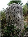
Milestone on the A4 (close-up)
"To Reading 8 miles, Bath 77". See http://www.geograph.org.uk/photo/4200078 for a wider view and http://www.geograph.org.uk/photo/4200094 for the other side.
Image: © Bikeboy
Taken: 21 Sep 2014
0.08 miles
2
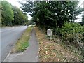
Milestone on the A4
See http://www.geograph.org.uk/photo/4200094 and http://www.geograph.org.uk/photo/4200110 for close-ups. "To Hyde Park Corner 30 miles, Maidenhead 4, Colnbrook 13" and on the other side, "To Reading 9 miles, Bath 76"
The A4 reached its height of importance as a coaching route between London and Bristol around 1836. After this the railways saw to its demise.
Image: © Bikeboy
Taken: 21 Sep 2014
0.08 miles
3
Milestone on the A4 (close up)
See http://www.geograph.org.uk/photo/4200078 for a wider view "To Hyde Park Corner 30 miles, Maidenhead 4, Colnbrook 13" See for the other side.
Image: © Bikeboy
Taken: 21 Sep 2014
0.08 miles
5
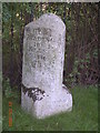
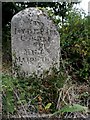
Old Milestone by the A4, Bath Road, Frogmore Farm
Carved stone post by the A4, in parish of Hurley (Windsor and Maidenhead District), Bath Road; Frogmore Farm, Knowl Hill, West of junction with Burchett's Green Road, on grass verge with a path in front, on South side of road. Bath Road limestone pillar, erected by the Maidenhead turnpike trust in the 19th century.
Inscription reads:-
: TO / READING / 9 / MILES / BATH / 78 : : Parish of / HURLEY / 1824 : : TO / HYDE PARK / CORNER / 30 / MILES / MAIDENHEAD / 4 / COLNBROOK / 13 :
Grade II listed.
List Entry Number: 1155761 https://historicengland.org.uk/listing/the-list/list-entry/1155761
Milestone Society National ID: BE_LB30
Image: © A Rosevear
Taken: 11 Sep 2001
0.09 miles
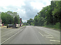
6
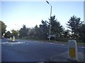
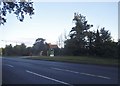
Bath Road at the junction of Burchetts Green Road
Image: © David Howard
Taken: 9 Aug 2015
0.10 miles
7
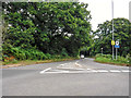
Hurley : Burchett's Green Road
Looking along Burchett's Green Road from Bath Road.
Image: © Lewis Clarke
Taken: 18 Jul 2019
0.12 miles
10
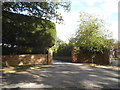
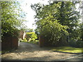
House entrances on Burchetts Green Road
Image: © David Howard
Taken: 9 Aug 2015
0.20 miles