1
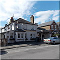
King George VI Day Centre, Clarence Road
'Situated in the heart of Windsor, the King George VI Day Centre was purpose-built by the Windsor Old People’s Welfare Association, a registered charity, as a lunch and social club for older Windsor residents. The Centre was opened in 1958 by H.R.H. Queen Elizabeth II."
Quote from Windsor OPWA web page.
Image: © Des Blenkinsopp
Taken: 30 Jul 2017
0.02 miles
2
King George VI Day Centre, Windsor
Located on the corner of Clarence Road and Clarence Court.
The day centre's website records that the King George VI Day Centre was purpose-built by the Windsor Old People's Welfare Association, a registered charity, as a lunch and social club for older Windsor residents. The Centre was opened in 1958 by H.R.H. Queen Elizabeth II. The King George VI Day Centre aims to provide a safe and friendly environment, where members are encouraged to maintain their independence and wellbeing through activities and social interaction.
Image: © Jaggery
Taken: 27 Apr 2013
0.02 miles
3
Albert Street, Windsor
Image: © Jonathan Thacker
Taken: 9 Oct 2010
0.04 miles
4
Albert Street, Windsor
Looking west from the corner of Vansittart Road.
Image: © Jaggery
Taken: 27 Apr 2013
0.06 miles
5
Albert Street, Windsor
Albert Street is a cul-de-sac of terraced houses. The ones on the left are not so attractively coloured.
Image: © Andrew Smith
Taken: 25 Feb 2006
0.06 miles
6
The Bexley Arms, Vansittart Road
A corner pub.
Image: © don cload
Taken: 8 Jun 2009
0.08 miles
7
SE corner of Clarence Road and Vansittart Road, Windsor
Clarence Road is on the left, Vansittart Road on the right.
Image: © Jaggery
Taken: 27 Apr 2013
0.08 miles
8
The Bexley Arms, Windsor
The pub at 50 Bexley Street, on the corner of Vansittart Road,
is named after Nicholas Vansittart (1766-1851) the first (and only) Baron Bexley.
Image: © Jaggery
Taken: 27 Apr 2013
0.09 miles
9
The Vansittart Arms name sign, Windsor
The sign outside this http://www.geograph.org.uk/photo/3599332 pub shows the coat of arms of the Vansittart family, formerly landowners in the area (and elsewhere in Berkshire). The motto FATA VIAM INVENIENT (The Fates will find a way)
is a quote from Virgil's Aeneid.
Image: © Jaggery
Taken: 27 Apr 2013
0.10 miles
10
The Vansittart Arms, Windsor
Viewed across Vansittart Road. The Vansittart family who had come from Holland in the 16th century were formerly landowners hereabouts, and elsewhere in Berkshire.
The Vansittarts also have a connection with the nearby Bexley Arms. http://www.geograph.org.uk/photo/3599313
Image: © Jaggery
Taken: 27 Apr 2013
0.10 miles


