IMAGES TAKEN NEAR TO
The Grange, WINDSOR, SL4 2PS
Introduction
This page details the photographs taken nearby to The Grange, SL4 2PS by members of the Geograph project.
The Geograph project started in 2005 with the aim of publishing, organising and preserving representative images for every square kilometre of Great Britain, Ireland and the Isle of Man.

There are currently over 7.5m images from over14,400 individuals and you can help contribute to the project by visiting https://www.geograph.org.uk
Image Map
Images are licensed for reuse under creativecommons.org/licenses/by-sa/2.0
Notes
- Clicking on the map will re-center to the selected point.
- The higher the marker number, the further away the image location is from the centre of the postcode.
Image Listing (94 Images Found)
Images are licensed for reuse under creativecommons.org/licenses/by-sa/2.0
Image
Details
Distance
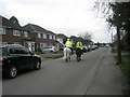
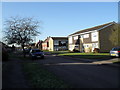
2
Looking from Church Road into Pollard Close
Image: © Basher Eyre
Taken: 2 Jan 2010
0.06 miles
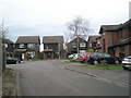
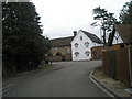
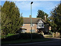
3
Looking from The Grange into Church Road
Image: © Basher Eyre
Taken: 2 Jan 2010
0.06 miles
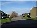
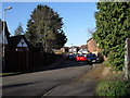
4
Approaching the junction of The Grange and Church Road
Image: © Basher Eyre
Taken: 28 Mar 2010
0.06 miles
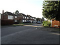
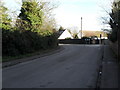
6
Approaching the junction of Church Road and Pollard Close
Image: © Basher Eyre
Taken: 2 Jan 2010
0.06 miles
9
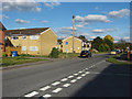
Church Road, Old Windsor
Housing association flats on Pollard Close from the junction of Cell farm Avenue.
Image: © Alan Hunt
Taken: 3 Oct 2014
0.07 miles