IMAGES TAKEN NEAR TO
Church Road, WINDSOR, SL4 2PH
Introduction
This page details the photographs taken nearby to Church Road, SL4 2PH by members of the Geograph project.
The Geograph project started in 2005 with the aim of publishing, organising and preserving representative images for every square kilometre of Great Britain, Ireland and the Isle of Man.

There are currently over 7.5m images from over14,400 individuals and you can help contribute to the project by visiting https://www.geograph.org.uk
Image Map
Images are licensed for reuse under creativecommons.org/licenses/by-sa/2.0
Notes
- Clicking on the map will re-center to the selected point.
- The higher the marker number, the further away the image location is from the centre of the postcode.
Image Listing (133 Images Found)
Images are licensed for reuse under creativecommons.org/licenses/by-sa/2.0
Image
Details
Distance
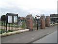
2
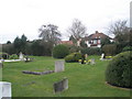
Tombstones & Houses, Church Road
A Victorian cemetery surrounded by more recent housing.
Image: © Des Blenkinsopp
Taken: 6 Feb 2020
0.02 miles
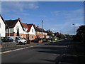
4
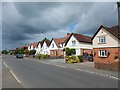
Old Windsor - Detached Houses in Church Street
Image: © James Emmans
Taken: 9 Jun 2017
0.02 miles
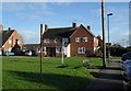
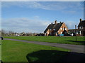
6
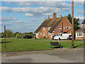
Church Road, Old Windsor
A small green with houses on either side and allotments behind.
Image: © Alan Hunt
Taken: 3 Oct 2014
0.03 miles

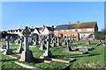
9
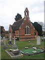
Former chapel in Old Windsor Cemetery (1)
Now used as a meeting place for the parish council.
Image: © Basher Eyre
Taken: 28 Mar 2010
0.04 miles