IMAGES TAKEN NEAR TO
Horton Road, SLOUGH, SL3 9HD
Introduction
This page details the photographs taken nearby to Horton Road, SL3 9HD by members of the Geograph project.
The Geograph project started in 2005 with the aim of publishing, organising and preserving representative images for every square kilometre of Great Britain, Ireland and the Isle of Man.

There are currently over 7.5m images from over14,400 individuals and you can help contribute to the project by visiting https://www.geograph.org.uk
Image Map
Images are licensed for reuse under creativecommons.org/licenses/by-sa/2.0
Notes
- Clicking on the map will re-center to the selected point.
- The higher the marker number, the further away the image location is from the centre of the postcode.
Image Listing (42 Images Found)
Images are licensed for reuse under creativecommons.org/licenses/by-sa/2.0
Image
Details
Distance
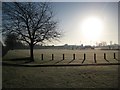
2
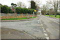
Junction on B376, Datchet
Pretty much a late winter version of the view in Image, without deciduous leaves or sunshine. The link road (actually named "Link Road") on the left goes via Lawn Close to the B470 London Road. On the right is a recreation ground.
Image: © Derek Harper
Taken: 1 Apr 2018
0.06 miles
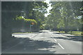
3
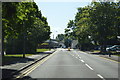
Horton Road, Datchet
The B376, seen from opposite Image You can catch an 11 to Slough from the bus stop.
Image: © Derek Harper
Taken: 1 Apr 2018
0.08 miles
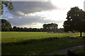
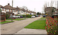
5
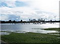
Datchet Recreation Ground
The 1900 Ordnance Survey map shows this area as Datchet Common.
Image: © Nigel Cox
Taken: 7 Dec 2008
0.08 miles
7
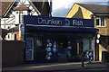
The Drunken Fish, Horton Road, Datchet
A fish and chip shop that is also an off-licence.
Image: © Robert Eva
Taken: 31 Jul 2017
0.09 miles
8
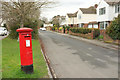
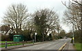
Horton Road, Datchet
The actual B376 Horton Road is off to the left, but these houses share its address, and are on a road linking Ditton Road to Linchfield Road. George V postbox SL3 169 is definitely leaning.
Image: © Derek Harper
Taken: 1 Apr 2018
0.09 miles
9
Lawn Close, Datchet
The cul-de-sac mentioned at Image In fact the line of the road continues after a wall about 180 metres away; although it is still called Lawn Close, it then becomes a cul-de-sac of Linchfield Road.
Image: © Derek Harper
Taken: 1 Apr 2018
0.10 miles