IMAGES TAKEN NEAR TO
Brackenforde, SLOUGH, SL3 7AU
Introduction
This page details the photographs taken nearby to Brackenforde, SL3 7AU by members of the Geograph project.
The Geograph project started in 2005 with the aim of publishing, organising and preserving representative images for every square kilometre of Great Britain, Ireland and the Isle of Man.

There are currently over 7.5m images from over14,400 individuals and you can help contribute to the project by visiting https://www.geograph.org.uk
Image Map
Images are licensed for reuse under creativecommons.org/licenses/by-sa/2.0
Notes
- Clicking on the map will re-center to the selected point.
- The higher the marker number, the further away the image location is from the centre of the postcode.
Image Listing (17 Images Found)
Images are licensed for reuse under creativecommons.org/licenses/by-sa/2.0
Image
Details
Distance
1
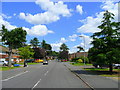
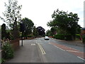
Halkingcroft 1
View east along this suburban road north-east of Slough.
Image: © Jonathan Billinger
Taken: 19 Jun 2008
0.07 miles
2
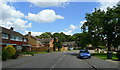
Halkingcroft 2
1960's suburb of Slough.
Image: © Jonathan Billinger
Taken: 19 Jun 2008
0.09 miles
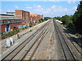
3
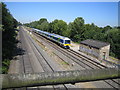
Langley: Main line railway
The view looking in the opposite direction to Darren's Image, from the Middlegreen Road bridge with a London-bound stopping train approaching.
Image: © Nigel Cox
Taken: 18 Jul 2006
0.15 miles
4
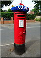
Yarn bombed George V postbox on Langley Road, Slough
Postbox No. SL3 126.
Image: © JThomas
Taken: 23 May 2022
0.15 miles
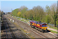
5
Railway Lines near Langley, Slough
These are the main train lines into London Paddington, about a mile east of Slough station. To the south of the lines is Slough's eastern suburb of Langley; to the north is the Slough branch of the Grand Union Canal and countryside.
Image: © Darren Smith
Taken: 10 Jul 2005
0.17 miles
6
Dolphin Junction
Railway at Dolphin Junction near Langley.
Image: © Wayland Smith
Taken: 14 Apr 2015
0.18 miles
8
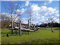
Climbing Thing For Kids
This is in Bloom Park beside the Slough Canal.
Image: © Des Blenkinsopp
Taken: 14 Mar 2013
0.19 miles
9
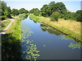
Grand Union Canal (Slough Arm)
Viewed looking towards Slough from the Middlegreen Road bridge, this was the last branch of the Grand Union Canal to be opened, as late as 1882, and long after the railway line that parallels it to the south. The canal also represents the boundary between the local government areas of Slough Borough Council (to the left) and South Bucks District Council (to the right).
Image: © Nigel Cox
Taken: 18 Jul 2006
0.19 miles
10
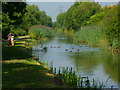
Orange Way after Wiltshire (472)
The ducks have gathered for the food being offered by this woman and child.
Image: © Shazz
Taken: 4 Sep 2013
0.21 miles