
IMAGES TAKEN NEAR TO
Shaggy Calf Lane, SLOUGH, SL2 5HW
Introduction
This page details the photographs taken nearby to Shaggy Calf Lane, SL2 5HW by members of the Geograph project.
The Geograph project started in 2005 with the aim of publishing, organising and preserving representative images for every square kilometre of Great Britain, Ireland and the Isle of Man.

There are currently over 7.5m images from over14,400 individuals and you can help contribute to the project by visiting https://www.geograph.org.uk
Image Map
Images are licensed for reuse under creativecommons.org/licenses/by-sa/2.0
Notes
- Clicking on the map will re-center to the selected point.
- The higher the marker number, the further away the image location is from the centre of the postcode.
Image Listing (28 Images Found)
Images are licensed for reuse under creativecommons.org/licenses/by-sa/2.0
Image
Details
Distance
2
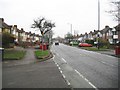
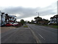
Slough: Shaggy Calf Lane
This delightfully named road must be a throw-back to the days when this area was agricultural. The houses appear to be typical 1920s/1930s semis, but the 1932 Ordnance Survey map of the area shows only a few isolated properties. Slough Borough Council's dark red wheelie bins are prominently on display.
Image: © Nigel Cox
Taken: 8 Jan 2009
0.10 miles
5
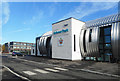
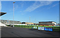
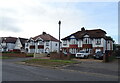
Arbour Park Sports Centre
A new stadium along Stoke Road.
Image: © Des Blenkinsopp
Taken: 2 Nov 2018
0.13 miles
6
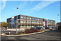
Lynch Hill Enterprise Academy
A new school opened in September 2014.
Image: © Des Blenkinsopp
Taken: 2 Nov 2018
0.14 miles
7
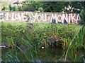
Graffiti: I Love You Monika
This art work is located 100 metres from the end of the Grand Union Canal's Slough Arm, close to Stoke Road in Slough. I hope it all went well with Monika and friend.
Image: © Rob Emms
Taken: 19 Sep 2017
0.16 miles
8
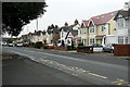
Stoke Road
This is the road from Stoke Poges, the B416 in the northern part of Slough. This shows a selection of Edwardian houses, many of which had had individual makeovers.
Image: © Graham Horn
Taken: 23 Feb 2012
0.17 miles
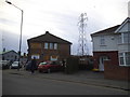
10
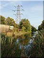
Slough arm of the Grand Union Canal
Seen from its conclusion, so a reverse view of Image and Image There is a strong view that this feature represents a so far unrealised opportunity for Slough; canal basins form major foci in several towns and cities.
The canal quickly crosses a gridline; the pylon is in Image
Image: © Derek Harper
Taken: 20 Sep 2010
0.19 miles