IMAGES TAKEN NEAR TO
Hawthorn Lane, SLOUGH, SL2 3TB
Introduction
This page details the photographs taken nearby to Hawthorn Lane, SL2 3TB by members of the Geograph project.
The Geograph project started in 2005 with the aim of publishing, organising and preserving representative images for every square kilometre of Great Britain, Ireland and the Isle of Man.

There are currently over 7.5m images from over14,400 individuals and you can help contribute to the project by visiting https://www.geograph.org.uk
Image Map
Images are licensed for reuse under creativecommons.org/licenses/by-sa/2.0
Notes
- Clicking on the map will re-center to the selected point.
- The higher the marker number, the further away the image location is from the centre of the postcode.
Image Listing (22 Images Found)
Images are licensed for reuse under creativecommons.org/licenses/by-sa/2.0
Image
Details
Distance
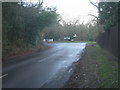
1
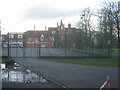
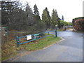
Car Park on Hawthorn Lane, Burnham Beeches
Image: © David Howard
Taken: 27 Jan 2018
0.05 miles
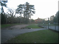
2
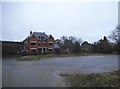
Entrance to car park on Burnham Beeches
Image: © David Howard
Taken: 27 Jan 2018
0.05 miles
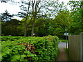
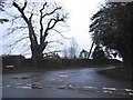
3
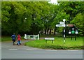
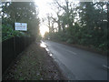
Junction on Hawthorn Lane
The walkers are entering Burnham Beeches on Sir Henry Peakes Drive.
Image: © Shazz
Taken: 17 May 2013
0.09 miles