IMAGES TAKEN NEAR TO
Blackpond Lane, SLOUGH, SL2 3EA
Introduction
This page details the photographs taken nearby to Blackpond Lane, SL2 3EA by members of the Geograph project.
The Geograph project started in 2005 with the aim of publishing, organising and preserving representative images for every square kilometre of Great Britain, Ireland and the Isle of Man.

There are currently over 7.5m images from over14,400 individuals and you can help contribute to the project by visiting https://www.geograph.org.uk
Image Map
Images are licensed for reuse under creativecommons.org/licenses/by-sa/2.0
Notes
- Clicking on the map will re-center to the selected point.
- The higher the marker number, the further away the image location is from the centre of the postcode.
Image Listing (12 Images Found)
Images are licensed for reuse under creativecommons.org/licenses/by-sa/2.0
Image
Details
Distance
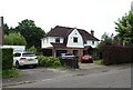
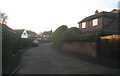
1
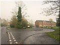
Highfield Court
A building containing six flats approached by a curving drive off Blackpond Lane (left).
Image: © Derek Harper
Taken: 19 Nov 2010
0.05 miles
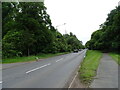
2
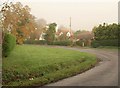
Blackpond Lane
The lane curves around a wide verge at the second of two sharp bends.
Image: © Derek Harper
Taken: 19 Nov 2010
0.10 miles
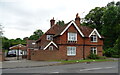
8
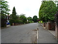
Linden Drive
Houses built in the grounds of what was once the family home. If only we had hung on until today!
Image: © Fernweh
Taken: 1 Jan 2013
0.20 miles
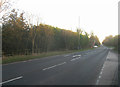
9
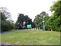
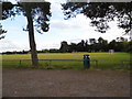
The exit from Farnham Royal playing fields
On Beaconsfield Road
Image: © David Howard
Taken: 4 Oct 2012
0.20 miles