IMAGES TAKEN NEAR TO
One Pin Place, SLOUGH, SL2 3AG

Introduction

This page details the photographs taken nearby to One Pin Place, SL2 3AG by members of the Geograph project.

The Geograph project started in 2005 with the aim of publishing, organising and preserving representative images for every square kilometre of Great Britain, Ireland and the Isle of Man.

There are currently over 7.5m images from over14,400 individuals and you can help contribute to the project by visiting https://www.geograph.org.uk

Image Map


Images are licensed for reuse under creativecommons.org/licenses/by-sa/2.0
Notes
  • Clicking on the map will re-center to the selected point.
  • The higher the marker number, the further away the image location is from the centre of the postcode.

Image Listing (7 Images Found)

Images are licensed for reuse under creativecommons.org/licenses/by-sa/2.0
Image
Details
Distance
1
Houses on Collum Green Road
Image: © JThomas Taken: 26 May 2022
0.02 miles
2
Elizabeth II postbox on Collum Green Road, Farnham Common
Postbox No. SL2 212.
Image: © JThomas Taken: 26 May 2022
0.03 miles
3
One Pin Lane at the junction of Collum Green Road
The house on the right has replaced the One Pin pub some time since 2008
Image: © David Howard Taken: 15 Jun 2017
0.04 miles
4
Parish Lane
Towards the A355.
Image: © JThomas Taken: 26 May 2022
0.05 miles
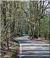
5
Collum Green Road near Hedgerley
Snaking west past the tautological Timber Wood.
Image: © Stephen Richards Taken: 25 Mar 2019
0.21 miles
6
Romsey Drive, Egypt
Image: © David Howard Taken: 15 Jun 2017
0.21 miles
7
Jones Way across the green at Hedgerley Hill
This open grassland with a football pitch and children's play area has houses all around it, and the houses back onto woodland.
Image: © David Hawgood Taken: 24 Jun 2005
0.24 miles