IMAGES TAKEN NEAR TO
Dropmore Road, SLOUGH, SL1 8NF
Introduction
This page details the photographs taken nearby to Dropmore Road, SL1 8NF by members of the Geograph project.
The Geograph project started in 2005 with the aim of publishing, organising and preserving representative images for every square kilometre of Great Britain, Ireland and the Isle of Man.

There are currently over 7.5m images from over14,400 individuals and you can help contribute to the project by visiting https://www.geograph.org.uk
Image Map
Images are licensed for reuse under creativecommons.org/licenses/by-sa/2.0
Notes
- Clicking on the map will re-center to the selected point.
- The higher the marker number, the further away the image location is from the centre of the postcode.
Image Listing (8 Images Found)
Images are licensed for reuse under creativecommons.org/licenses/by-sa/2.0
Image
Details
Distance
1
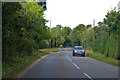
Dropmore Road heading north
Towards Beaconsfield from Burnham.
Image: © Robin Webster
Taken: 26 Sep 2021
0.05 miles
3
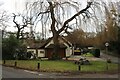
House on the corner of Dropmore Road and Horseshoe Hill
Image: © David Howard
Taken: 17 Feb 2022
0.10 miles
4
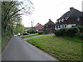
Horseshoe Hill
Between Brook End and Littleworth Corner.
Image: © Andrew Smith
Taken: 29 Apr 2006
0.11 miles
5
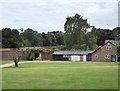
Walled garden and estate buildings, Horseshoe Hill House
There is a right of way running through the grounds of Horseshoe Hill House, though (so far) I seem to be the only member of the Geograph community to have discovered it. The main entrance from Horseshoe Hill (it has to be said) looks very private, and the footpath entrance partly concealed.
I assume that the garden enclosed by high walls was originally a kitchen garden, though - seen at this distance - it no longer seems to be used for that purpose.
Image: © Stefan Czapski
Taken: 30 Jun 2017
0.12 miles
6
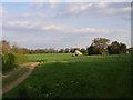
Farmland at Brook End
Fields alongside Dropmore Road and Lower Brook End.
Image: © Andrew Smith
Taken: 29 Apr 2006
0.16 miles
7
Barn and wheat field by Littleworth Common
The barn is by Lower Brook End farm. View from public footpath.
Image: © David Hawgood
Taken: 31 May 2008
0.19 miles