IMAGES TAKEN NEAR TO
Taplow Common Road, SLOUGH, SL1 8LR
Introduction
This page details the photographs taken nearby to Taplow Common Road, SL1 8LR by members of the Geograph project.
The Geograph project started in 2005 with the aim of publishing, organising and preserving representative images for every square kilometre of Great Britain, Ireland and the Isle of Man.

There are currently over 7.5m images from over14,400 individuals and you can help contribute to the project by visiting https://www.geograph.org.uk
Image Map
Images are licensed for reuse under creativecommons.org/licenses/by-sa/2.0
Notes
- Clicking on the map will re-center to the selected point.
- The higher the marker number, the further away the image location is from the centre of the postcode.
Image Listing (10 Images Found)
Images are licensed for reuse under creativecommons.org/licenses/by-sa/2.0
Image
Details
Distance
1
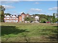
Grovefield Hotel
Early 1900s-former home of John Fuller of Fullers Brewery.
Image: © Kevin White
Taken: 25 Sep 2009
0.01 miles
2
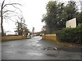
The entrance to Grovefield Park Hotel, Burnham
Image: © David Howard
Taken: 27 Jan 2018
0.03 miles
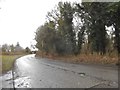
4
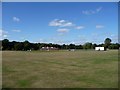
Taplow Common Road
Looking north by the entrance to Burnham Memorial Cricket Ground.
Image: © Robin Webster
Taken: 8 Dec 2019
0.15 miles
6
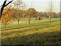
Trees, Huntswood Golf Club
Part of a row of trees (the leafier one on the left is nearer and out of line) on the eastern edge of the course, seen from the bridleway from Taplow Common Road to Hitcham and close to Image
Image: © Derek Harper
Taken: 19 Nov 2010
0.17 miles
7
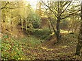
Hole in Hitcham Park
One of those large holes you come across, usually in woodland, from time to time. I always assumed they were most likely to be bomb craters, or disused quarries. This page on the history of Burnham https://ubp.buckscc.gov.uk/SingleResult.aspx?uid=TBC715 has a host of local facts, some of which might also be relevant. It is beside the bridleway from Taplow Common Road to Hitcham as it curves around the patch of woodland containing the hole, next to Huntswood Golf Club.
Image: © Derek Harper
Taken: 19 Nov 2010
0.20 miles
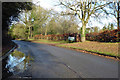
9
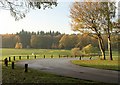
Entrance drive to Huntswood Golf Club
The drive has crossed the woodland of Hitcham Ride, and performs a sweeping bend to the north to reach the clubhouse. The golf course, with bunkers and a small lake, and Hunt's Wood beyond, is in Image
Image: © Derek Harper
Taken: 19 Nov 2010
0.21 miles
10
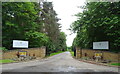
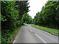
Entrance to Huntswood Golf Club
Off Taplow Common Road.
Image: © JThomas
Taken: 26 May 2022
0.22 miles