
IMAGES TAKEN NEAR TO
White Hart Road, SLOUGH, SL1 2SF
Introduction
This page details the photographs taken nearby to White Hart Road, SL1 2SF by members of the Geograph project.
The Geograph project started in 2005 with the aim of publishing, organising and preserving representative images for every square kilometre of Great Britain, Ireland and the Isle of Man.

There are currently over 7.5m images from over14,400 individuals and you can help contribute to the project by visiting https://www.geograph.org.uk
Image Map
Images are licensed for reuse under creativecommons.org/licenses/by-sa/2.0
Notes
- Clicking on the map will re-center to the selected point.
- The higher the marker number, the further away the image location is from the centre of the postcode.
Image Listing (64 Images Found)
Images are licensed for reuse under creativecommons.org/licenses/by-sa/2.0
Image
Details
Distance
2
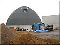
Chalvey: Slough Borough Council salt dome
Located at the rear of Slough Borough Council's Chalvey depot is this modern salt dome building. These circular buildings with wooden roofs are specifically designed to store salt to be used on roads during the winter without the salt being damaged by dampness during storage and by minimizing the risk of salt being leached into the ground or into the drainage system. They are also designed to enable the efficient delivery of the salt by HGVs and then the quick and efficient loading of distribution gritting vehicles.
Image: © Nigel Cox
Taken: 8 Jan 2009
0.08 miles
3
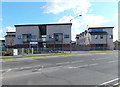
Greenwatt Way, Chalvey, Slough
Viewed across High Street. Developed by energy company SSE plc (formerly Scottish and Southern Energy plc), the zero-carbon housing is compliant with Code 6 of the Code for Sustainable Homes,
the highest possible standard. The development is a mixture of two and three bedroom family houses and one bedroom flats.
Features include rainwater harvesting, grey water recycling, triple-glazed windows and enhanced insulation. The dwellings receive their electrical power from solar PV tiles which cover the entire roof. Heating and hot water is supplied from an innovative low temperature, low heat loss, district heating system powered by four types of renewable sources: ground source heat pumps, air source heat pumps, solar thermal technology and a biomass boiler.
Image: © Jaggery
Taken: 27 Apr 2013
0.10 miles
4

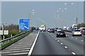
Joining the M4 at Junction 6
The entry sliproad at Junction 6 meets with heavy, slow moving traffic on the main eastbound carriageway of the M4.
Image: © David Dixon
Taken: 9 Apr 2015
0.11 miles
6
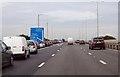
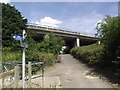
M4 traffic queueing for junction 6
Turning off for Slough and Windsor.
Image: © Julian P Guffogg
Taken: 7 Aug 2013
0.12 miles
8
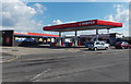
Murco and Costcutter, Chalvey, Slough
The Murco filling station and Costcutter shop are on the corner of High Street, Chalvey and Turton Way.
Image: © Jaggery
Taken: 27 Apr 2013
0.12 miles
10
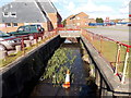
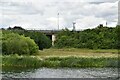
Chalvey Ditch, Slough
Viewed from the edge of High Street, Chalvey, near Chalvey Sports & Social Club. http://www.geograph.org.uk/photo/3434666
Chalvey Ditch is a stream, mostly culverted hereabouts, which empties into the Thames below Eton.
As well as the traffic cone dumped in the stream, there was also a dumped shopping trolley in the water, out of shot on the camera side.
Image: © Jaggery
Taken: 27 Apr 2013
0.13 miles