1
Development opportunity in Harden Park, Alderley Edge
Fencing encloses the former Yesterdays Nightclub site. A notice states that the approximately
4 acre site has the potential for residential redevelopment subject to consents.
Image: © Jaggery
Taken: 8 Sep 2014
0.02 miles
2
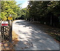
Vehicles will be apprehended on a private road in Harden Park, Alderley Edge
Viewed from the public side of a private road. Next to a yellow closed circuit television notice,
a red notice on a fence shows
PRIVATE ROAD No unauthorised access beyond this gate. Vehicles will be apprehended.
Image: © Jaggery
Taken: 8 Sep 2014
0.03 miles
3
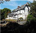
Derelict former County Hotel in Alderley Edge
Viewed from Harden Park. Now boarded up, derelict and fenced off, http://www.geograph.org.uk/photo/4160031
the County Hotel closed down in November 2009. The building was originally a Victorian villa.
Image: © Jaggery
Taken: 8 Sep 2014
0.05 miles
4
Fenced-off former County Hotel in Alderley Edge
Viewed from the B5359. The County Hotel at the edge of Harden Park closed down in November 2009. The building was originally a Victorian villa. http://www.geograph.org.uk/photo/4160037 to a closer view.
Image: © Jaggery
Taken: 8 Sep 2014
0.05 miles
5
The Edge Hockey Centre, Alderley Edge
The home of Alderley Edge Hockey Club, set back from the east side of the B5359.
Image: © Jaggery
Taken: 8 Sep 2014
0.07 miles
6
Entrance to The Ryleys Games Field, Alderley Edge
Viewed across the B5359. The Ryleys is a girls and boys preparatory school.
Image: © Jaggery
Taken: 8 Sep 2014
0.08 miles
7
Entrance to The Ryleys Games Field
The Ryleys is a girls and boys preparatory school.
Image: © Anthony Parkes
Taken: 21 Aug 2016
0.08 miles
8
The Merlin, Alderley Edge
An Innkeeper's Lodge hotel, The Merlin is set back from the east side of Wilmslow Road in the north of Alderley Edge. The building was originally a Victorian villa named Lindow Grove.
Image: © Jaggery
Taken: 8 Sep 2014
0.09 miles
9
The Merlin Restaurant, Alderley Edge
Image: © Glyn Drury
Taken: 6 Sep 2009
0.10 miles
10
Castle Rock Studios, Alderley Edge
Recording studios set back from the west side of the B5359 in the north of Alderley Edge.
Image: © Jaggery
Taken: 8 Sep 2014
0.11 miles


