IMAGES TAKEN NEAR TO
Hill Top Avenue, WILMSLOW, SK9 2JE

Introduction

This page details the photographs taken nearby to Hill Top Avenue, SK9 2JE by members of the Geograph project.

The Geograph project started in 2005 with the aim of publishing, organising and preserving representative images for every square kilometre of Great Britain, Ireland and the Isle of Man.

There are currently over 7.5m images from over14,400 individuals and you can help contribute to the project by visiting https://www.geograph.org.uk

Image Map


Images are licensed for reuse under creativecommons.org/licenses/by-sa/2.0
Notes
  • Clicking on the map will re-center to the selected point.
  • The higher the marker number, the further away the image location is from the centre of the postcode.

Image Listing (57 Images Found)

Images are licensed for reuse under creativecommons.org/licenses/by-sa/2.0
  • ...
Image
Details
Distance
1
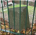
Old Milestone by the B5166, Lacey Green
Carved stone post by the B5166 (was A34), in parish of Wilmslow (Vale Royal District), Manchester Road, South of junction with Old Road, behind railings at top of bank in garden, on West side of road. Wilmslow stone, erected by the Wilmslow turnpike trust in the 19th century. Inscription reads:- : 12 / Miles / to / Manchester / Centre / (St Ann's Square) : : ¼ / Mile / to / Wilmslow : Cheshire HER. SMR Number: 5599 https://www.heritagegateway.org.uk/Gateway/Results_Single.aspx?uid=MCH16562&resourceID=1004 Milestone Society National ID: CH_MAWM12
Image: © Mike Faherty Taken: 20 Oct 2009
0.06 miles
2
Around Wilmslow Park (7)
Path alongside the railway
Image: © Anthony O'Neil Taken: 19 Mar 2022
0.10 miles
3
Wilmslow Bridge
Stone and iron bridge carrying Manchester Road over the River Bollin.
Image: © Mike Faherty Taken: 20 Oct 2009
0.10 miles
4
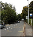
Manchester Road bus stops, Wilmslow
Alongside the B5166 Manchester Road which crosses the River Bollin about 30 metres ahead.
Image: © Jaggery Taken: 8 Sep 2014
0.12 miles
5
Path through woodland, north of Wilmslow
Image: © Philip Cornwall Taken: 23 Jul 2021
0.12 miles
6
War Memorial Gardens, Wilmslow
On the north side of Mlll Street, between Manchester Road to the east, and Chancel Lane and the Church of St Bartholomew http://www.geograph.org.uk/photo/4157368 to the west.
Image: © Jaggery Taken: 8 Sep 2014
0.12 miles
7
Around Wilmslow Park (8)
Pond beside the path
Image: © Anthony O'Neil Taken: 19 Mar 2022
0.13 miles
8
Woodland between railway line and the A34 north of Wilmslow
Image: © Philip Cornwall Taken: 23 Jul 2021
0.13 miles
9
Chancel Lane in Wilmslow
An Autumnal scene.
Image: © philandju Taken: 23 Oct 2018
0.14 miles
10
Around Wilmslow Park (6)
Steps to the railway
Image: © Anthony O'Neil Taken: 19 Mar 2022
0.14 miles
  • ...