IMAGES TAKEN NEAR TO
Sandhurst Drive, WILMSLOW, SK9 2GP
Introduction
This page details the photographs taken nearby to Sandhurst Drive, SK9 2GP by members of the Geograph project.
The Geograph project started in 2005 with the aim of publishing, organising and preserving representative images for every square kilometre of Great Britain, Ireland and the Isle of Man.

There are currently over 7.5m images from over14,400 individuals and you can help contribute to the project by visiting https://www.geograph.org.uk
Image Map
Images are licensed for reuse under creativecommons.org/licenses/by-sa/2.0
Notes
- Clicking on the map will re-center to the selected point.
- The higher the marker number, the further away the image location is from the centre of the postcode.
Image Listing (14 Images Found)
Images are licensed for reuse under creativecommons.org/licenses/by-sa/2.0
Image
Details
Distance
1
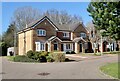
Around Wilmslow Park (13)
Gladewood Close. 'The Villas'
Image: © Anthony O'Neil
Taken: 19 Mar 2022
0.05 miles
2
Around Wilmslow Park (12)
Modern period house at 'The Villas'
Image: © Anthony O'Neil
Taken: 19 Mar 2022
0.06 miles
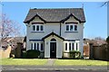
3
Around Wilmslow Park (15)
Shades of the 'Arts & Crafts'?
Image: © Anthony O'Neil
Taken: 19 Mar 2022
0.06 miles
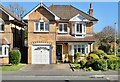
4
Around Wilmslow Park (14)
Terrace at 'The Villas'
Image: © Anthony O'Neil
Taken: 19 Mar 2022
0.07 miles
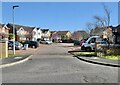
6
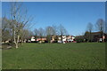
Around Wilmslow Park (11)
Green space at 'The Villas' housing development
Image: © Anthony O'Neil
Taken: 19 Mar 2022
0.11 miles
7
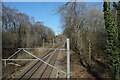
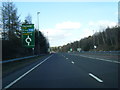
Around Wilmslow Park (10)
Railway northwards to Stockport
Image: © Anthony O'Neil
Taken: 19 Mar 2022
0.11 miles
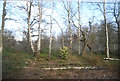
8
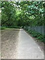
Footpath adjacent to railway line, North of Wilmslow
Footpath as it enters woodland area near Alveston Drive
Image: © Philip Cornwall
Taken: 23 Jul 2021
0.12 miles
9
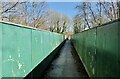
Around Wilmslow Park (9)
Railway footbridge
Image: © Anthony O'Neil
Taken: 19 Mar 2022
0.17 miles