IMAGES TAKEN NEAR TO
Ashdale Drive, CHEADLE, SK8 3SY
Introduction
This page details the photographs taken nearby to Ashdale Drive, SK8 3SY by members of the Geograph project.
The Geograph project started in 2005 with the aim of publishing, organising and preserving representative images for every square kilometre of Great Britain, Ireland and the Isle of Man.

There are currently over 7.5m images from over14,400 individuals and you can help contribute to the project by visiting https://www.geograph.org.uk
Image Map
Images are licensed for reuse under creativecommons.org/licenses/by-sa/2.0
Notes
- Clicking on the map will re-center to the selected point.
- The higher the marker number, the further away the image location is from the centre of the postcode.
Image Listing (11 Images Found)
Images are licensed for reuse under creativecommons.org/licenses/by-sa/2.0
Image
Details
Distance
2
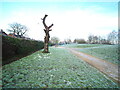
Dead tree near St Annes Road North, Heald Green
Image: © Benjamin Shaw
Taken: 2 Jan 2021
0.08 miles
3
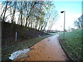
Footpath connecting St. Anne's Road North with Cheadle Royal Business Park
Image: © Benjamin Shaw
Taken: 2 Jan 2021
0.12 miles
4
Footpath at Brooks Drive, Cheadle Royal Business Park
Image: © Benjamin Shaw
Taken: 2 Jan 2021
0.16 miles
5

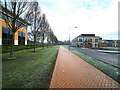
Gatley Golf Course from the air
On final approach to Manchester Airport from the north east.
Image: © Thomas Nugent
Taken: 13 Jun 2014
0.18 miles
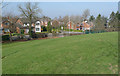
6
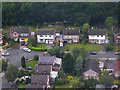
Detached Houses at Heald Green
On the approach to Manchester Airport.
Image: © David Dixon
Taken: 16 Jul 2016
0.19 miles
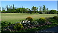
7
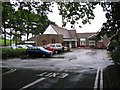
St Annes Hospice
This image taken from sj849865 looks east across the grid line at St Annes Hospice which is just in Square SJ850865.
Image: © Dave Smethurst
Taken: 10 Sep 2005
0.22 miles
8
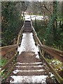
Bridge over stream at Cheadle Royal Business Park
Image: © Benjamin Shaw
Taken: 1 Jan 2021
0.23 miles
9
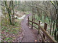
Path through High Grove woods at Cheadle Royal Business Park
Image: © Benjamin Shaw
Taken: 1 Jan 2021
0.23 miles