IMAGES TAKEN NEAR TO
Torkington Road, STOCKPORT, SK7 6NP
Introduction
This page details the photographs taken nearby to Torkington Road, SK7 6NP by members of the Geograph project.
The Geograph project started in 2005 with the aim of publishing, organising and preserving representative images for every square kilometre of Great Britain, Ireland and the Isle of Man.

There are currently over 7.5m images from over14,400 individuals and you can help contribute to the project by visiting https://www.geograph.org.uk
Image Map
Images are licensed for reuse under creativecommons.org/licenses/by-sa/2.0
Notes
- Clicking on the map will re-center to the selected point.
- The higher the marker number, the further away the image location is from the centre of the postcode.
Image Listing (10 Images Found)
Images are licensed for reuse under creativecommons.org/licenses/by-sa/2.0
Image
Details
Distance
1
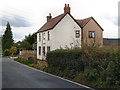
Holly Farm
Holly Farm on Torkington Road.
Image: © David Dixon
Taken: 18 Sep 2012
0.06 miles
2
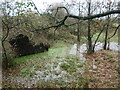
Waterlogged land and fallen tree near Holly Farm
The dark shape is the exposed root plate of the fallen tree. The flooded land is on the north bank of Ochrelay Brook.
Image: © Christine Johnstone
Taken: 30 Nov 2021
0.09 miles
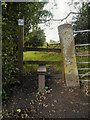
3
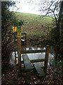
Public footpath crossing Ochrelay Brook
Or not, in this case. After recent wet weather, the plank footbridge between the two stiles is well under water.
Image: © Christine Johnstone
Taken: 30 Nov 2021
0.09 miles
4
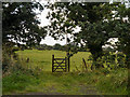
Gate and Field
Gate onto farmland, from Torkington Road.
Image: © David Dixon
Taken: 18 Sep 2012
0.10 miles
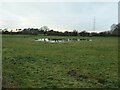
5
Paddock with horses, near Holly Farm
On the south side of Torkington Road.
Image: © Christine Johnstone
Taken: 30 Nov 2021
0.10 miles
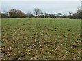
6
Waterlogged field, near Torkington
Following wet weather.
Image: © Christine Johnstone
Taken: 30 Nov 2021
0.16 miles
7
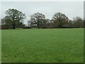
Farmland east of Torkington
Between Broadoak Farm and Holly Farm. About 107 metres above sea level.
Image: © Christine Johnstone
Taken: 30 Nov 2021
0.19 miles
8
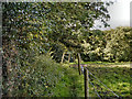
Path to Broadoak Farm
Path from Torkington Road.
Image: © David Dixon
Taken: 18 Sep 2012
0.21 miles
10
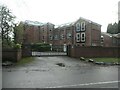
Torkington Manor
By the 1930s this Victorian building had been split into two residences - Manor House and Harefield. It has since been converted into numerous apartments.
Image: © Christine Johnstone
Taken: 30 Nov 2021
0.24 miles