1
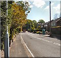
Fieldhouse Lane
Image: © Gerald England
Taken: 12 May 2009
0.02 miles
2
Strines Road
The B6101 from Marple to New Mills.
Image: © Gerald England
Taken: 12 May 2009
0.04 miles
3
Strines Road (B6101) at Marple
Strines Road, heading out of Marple, towards Strines and New Mills.
Image: © David Dixon
Taken: 22 Sep 2012
0.07 miles
4
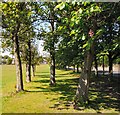
Avenue of Trees
Trees on the recreation ground alongside Arkwright Road.
Image: © Gerald England
Taken: 12 May 2009
0.09 miles
5
Bleak House and the Goyt Valley near Marple, Stockport
The substantial and tall two storey house (plus attic and basement) is early 19th century and was a mill manager's house. It is Grade II listed. It is seen here by looking north-east from the Peak Forest Canal, across the Goyt Valley, close to Marple Junction. I have seen the rowan trees here look even more spectacular!
Image: © Roger Kidd
Taken: 7 Sep 2014
0.10 miles
6
Across the Goyt Valley, near Marple, Stockport
From the Peak Forest Canal, this is looking across Strines Road (B6101) towards Mill Brow.
Image: © Roger D Kidd
Taken: 5 Sep 2014
0.11 miles
7
The Goyt Valley near Marple, Stockport
The view is across the Goyt Valley, seen from the Peak Forest canal near Marple Junction.
Bleak House. The substantial and tall two storey house (plus attic and basement) is early 19th century and was a mill manager's house. It is Grade II listed. It is seen here by looking east from the Peak Forest Canal, close to Marple Junction.
Image: © Roger D Kidd
Taken: 24 Aug 2007
0.11 miles
8
Canalside house with rowan tree near Marple Junction, Stockport
The view with the rowan tree and cottage below the embankment was even more spectacular and eye catching from a narrowboat in mid canal than from the tow-path.
Bleak House. The substantial and tall two storey house (plus attic and basement) is early 19th century and was a mill manager's house. It is Grade II listed. It is seen here by looking north-east from the Peak Forest Canal, across the Goyt Valley, close to Marple Junction.
https://britishlistedbuildings.co.uk/101259994-bleak-house-marple-south-ward
Image: © Roger D Kidd
Taken: 24 Aug 2007
0.11 miles
9
Road from Roman Lakes
The rough pot-holed road from Roman Lakes.
Image: © Gerald England
Taken: 28 Aug 1993
0.12 miles
10
Lake Road
The road out of Roman Lakes at Bottom's Bridge.
Image: © Gerald England
Taken: 8 May 2017
0.12 miles


