1
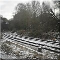
Winnington Road Bridge
At the end of Winnington Road, on the Ley Hey Park estate in Marple, the metalled road ends at this track crossing the railway bridge to the north of Rose Hill Station.
Image: © Roger May
Taken: 4 Dec 2005
0.12 miles
2
Marple Locks, Peak Forest Canal
The boat has just ascended the second lock from the bottom. These locks were only restored in the 1970s after a long period of disuse and dereliction.
Image: © Dr Neil Clifton
Taken: 13 Apr 1981
0.13 miles
3
Branch line to Marple Rose Hill
Image: © N Chadwick
Taken: 11 Dec 2022
0.16 miles
4
Below lock #3 on the Peak Forest Canal
In the flight of 16 locks that lift the canal up and around Marple
Image: © Graham Hogg
Taken: 23 Jun 2015
0.17 miles
5
Barge between locks
This barge was going north, which is down the flight at this point. It is currently between Locks 2 and 1 of the Peak Forest Canal.
Image: © Bill Boaden
Taken: 10 Aug 2010
0.17 miles
6
Below lock #2 on the Peak Forest Canal
In the flight of 16 locks that lift the canal up and around Marple
Image: © Graham Hogg
Taken: 23 Jun 2015
0.17 miles
7
Lock 2, Marple locks, 1984
Ahead is lock 3. These locks are very deep, with a mean depth over the 16 lock flight of 3.99 m (13.1 ft).
Image: © Robin Webster
Taken: 23 Apr 1984
0.17 miles
8
Marple Locks No 2 east of Stockport
This telephoto assisted image was taken by looking north-west towards Marple Locks No 2 from the footbridge at Lock No 3.
The Marple flight on the Peak Forest Canal consists of sixteen deep locks in a mile. The total fall (or rise) provided is 209ft 6in (almost 64 metres). The canal was opened to navigation by 1796 but not enough money remained to build these locks. A temporary tramway was installed and used until 1804, when the locks were completed. https://en.wikipedia.org/wiki/Marple_Lock_Flight
Image: © Roger Kidd
Taken: 7 Sep 2014
0.17 miles
9
Peak Forest Canal, Lock#2
Lock number 4 is one of the 16 locks in the "Marple Flight" which raise the Peak Forest Canal by 209 feet (64m) over the course of a mile.
Image: © David Dixon
Taken: 28 Nov 2012
0.17 miles
10
The start of the climb
No climbing today, as it happens, when the lock system is icebound but here we are at number 1 lock of the Marple flight on the Peak Forest Canal. 16 locks will lift you 209' over the next mile and a half, or so. Each lock lifts the boat about 13' and the passage through each lock takes a scarcely believable 44,000 gallons of water.
Image: © Roger Lombard
Taken: 4 Jan 2010
0.17 miles


