IMAGES TAKEN NEAR TO
Merepool Close, STOCKPORT, SK6 6JR
Introduction
This page details the photographs taken nearby to Merepool Close, SK6 6JR by members of the Geograph project.
The Geograph project started in 2005 with the aim of publishing, organising and preserving representative images for every square kilometre of Great Britain, Ireland and the Isle of Man.

There are currently over 7.5m images from over14,400 individuals and you can help contribute to the project by visiting https://www.geograph.org.uk
Image Map (Loading...)


Getting Data...Please wait
Leaflet Map data © OpenStreetMap
Images are licensed for reuse under creativecommons.org/licenses/by-sa/2.0
Notes
- Clicking on the map will re-center to the selected point.
- The higher the marker number, the further away the image location is from the centre of the postcode.
Image Listing (5 Images Found)
Images are licensed for reuse under creativecommons.org/licenses/by-sa/2.0
Image
Details
Distance
2

Marple Hall School - Isherwood Building
Image: © Anthony Parkes
Taken: 30 Jan 2013
0.18 miles
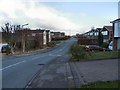
3

Marple Hall Drive
From the corner of Flagg Wood Avenue
Image: © Gerald England
Taken: 15 Dec 2009
0.20 miles
4
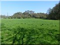
Turncliff Wood
Turncliff Wood is on a small hill within an abandoned meander of the River Goyt.
Image: © Dave Dunford
Taken: 8 Apr 2017
0.22 miles
5

Bus standing area at Marple Hill School
There are stands for at least 13 buses here.
Image: © Graham Hogg
Taken: 3 Jan 2022
0.24 miles