IMAGES TAKEN NEAR TO
Kingfisher Mews, Stockport Road, STOCKPORT, SK6 6DA

Introduction

This page details the photographs taken nearby to Kingfisher Mews, Stockport Road, SK6 6DA by members of the Geograph project.

The Geograph project started in 2005 with the aim of publishing, organising and preserving representative images for every square kilometre of Great Britain, Ireland and the Isle of Man.

There are currently over 7.5m images from over14,400 individuals and you can help contribute to the project by visiting https://www.geograph.org.uk

Image Map


Images are licensed for reuse under creativecommons.org/licenses/by-sa/2.0
Notes
  • Clicking on the map will re-center to the selected point.
  • The higher the marker number, the further away the image location is from the centre of the postcode.

Image Listing (376 Images Found)

Images are licensed for reuse under creativecommons.org/licenses/by-sa/2.0
  • ...
Image
Details
Distance
1
The Navigation
A Robinson's pub close to the canal in Marple.
Image: © philandju Taken: 31 Jul 2017
0.00 miles
2
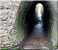
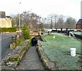
The horse tunnel
The tunnel was used to lead the unhitched barge horses under the B6101.
Image: © philandju Taken: 31 Jul 2017
0.01 miles
3
Marple canal towpath tunnel
The tunnel passes under the man road. Note the grooves worn into the stonework by the horse towropes
Image: © Bob Abell Taken: 6 Jun 2010
0.02 miles
4
Peak Forest Canal at Possetts Bridge, bridge #18
Image: © Ian S Taken: 3 Mar 2022
0.02 miles
5
Marple Lock #13
Lock number 13 (of 16) on the Peak Forest Canal at Marple. The cobbled towpath goes through an underpass of Stockport Road.
Image: © Gerald England Taken: 15 Dec 2008
0.03 miles
6
Lock 13 at Marple
Part of the flight of locks at Stockport Road. The tunnel is for towpath users to pass under the road
Image: © Raymond Knapman Taken: 2 Nov 2011
0.03 miles
7
Towpath tunnel alongside Lock 13, Peak Forest Canal
Taking the towpath under Possett Bridge [No 18]. Halfway along a side tunnel leads down some steps to the lower side of the bottom lock gates [useful for stepping on and off boats].
Image: © Christine Johnstone Taken: 11 May 2014
0.03 miles
8
Marple, Lock No 13
On the Marple Flight, Peak Forest Canal. https://canalrivertrust.org.uk/places-to-visit/destination/86/marple-locks
Image: © Mike Faherty Taken: 21 Jan 2017
0.03 miles
9
Marple Locks No 13 east of Stockport
Marple Locks No 13 on The Peak Forest Canal is by Possett Bridge, No 18, which carries Stockport Road. I think the tail gates were left open by a descending crew. Very lazy! The Marple flight consists of sixteen deep locks in a mile. The total fall (or rise) provided is 209ft 6in (almost 64 metres). The canal was opened to navigation by 1796 but not enough money remained to build these locks. A temporary tramway was installed and used until 1804, when the locks were completed. The short pounds between Locks 13 to 16 include large open side ponds to assist with water management. Image]
Image: © Roger Kidd Taken: 7 Sep 2014
0.03 miles
10
Marple Locks No 13 east of Stockport
Marple Locks No 13 on The Peak Forest Canal is by Possett Bridge, No 18, which carries Stockport Road. I think the tail gates were left open by a descending crew. Very lazy! The Marple flight consists of sixteen deep locks in a mile. The total fall (or rise) provided is 209ft 6in (almost 64 metres). The canal was opened to navigation by 1796 but not enough money remained to build these locks. A temporary tramway was installed and used until 1804, when the locks were completed. The short pounds between Locks 13 to 16 include large open side ponds to assist with water management. Image]
Image: © Roger Kidd Taken: 7 Sep 2014
0.03 miles
  • ...