1
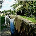
Towpath by Marple Locks No 15 east of Stockport
Looking north towards Lock No 14, Stockport and Manchester.
The Marple flight on the Peak Forest Canal consists of sixteen deep locks in a mile. The total fall (or rise) provided is 209ft 6in (almost 64 metres). The canal was opened to navigation by 1796 but not enough money remained to build these locks. A temporary tramway was installed and used until 1804, when the locks were completed. https://en.wikipedia.org/wiki/Marple_Lock_Flight
Image: © Roger Kidd
Taken: 7 Sep 2014
0.04 miles
2
Peak Forest Canal, Bridge at Lock#15
Lock#15 is one of the Marple flight of locks linking the upper and lower sections of the Peak Forest Canal.
Image: © David Dixon
Taken: 22 Sep 2012
0.04 miles
3
Marple Locks No 15 east of Stockport
Marple Locks No 15 on The Peak Forest Canal, looking north towards Stockport and Manchester.
The Marple flight consists of sixteen deep locks in a mile. The total fall (or rise) provided is 209ft 6in (almost 64 metres). The canal was opened to navigation by 1796 but not enough money remained to build these locks. A temporary tramway was installed and used until 1804, when the locks were completed.
The short pounds between Locks 13 to 16 include large open side ponds to assist with water management.
It appears that the lock tail gates (and others down the flight) have been left open by a crew descending the flight. This is not appreciated, because if these gates are left open, and the top gate is leaking, the total draining of the pound above the lock ( and even the pound above that) is possible in quite a short time, then the canal is impassable until water is replenished by controlled flow through the upper locks. All paddles should be lowered (not dropped!) and gates closed to minimise water loss.
Image: © Roger Kidd
Taken: 7 Sep 2014
0.04 miles
4
Marple Locks No 14 east of Stockport
Marple Locks No 14 on The Peak Forest Canal.
The Marple flight consists of sixteen deep locks in a mile. The total fall (or rise) provided is 209ft 6in (almost 64 metres). The canal was opened to navigation by 1796 but not enough money remained to build these locks. A temporary tramway was installed and used until 1804, when the locks were completed.
The short pounds between Locks 13 to 16 include large open side ponds to assist with water management.
Image: © Roger Kidd
Taken: 7 Sep 2014
0.04 miles
5
Between the locks
Looking from Lock #15 towards Lock #14 on the Peak Forest Canal.
Image: © Gerald England
Taken: 23 Jul 2015
0.04 miles
6
Lock 14 on the Marple Flight
On the Lower the Peak Forest Canal this is near the end of a flight of 15 locks.
Image: © Graham Hogg
Taken: Unknown
0.04 miles
7
Boat about to leave Lock 15, Peak Forest Canal
Seen from the top of Lock 14.
Image: © Christine Johnstone
Taken: 11 May 2014
0.04 miles
8
Gates at Lock #15
A close view of the lock-gates on the Peak Forest Canal.
Image: © Gerald England
Taken: 23 Jul 2015
0.04 miles
9
Marple Locks No 15 east of Stockport
Marple Locks No 15 on The Peak Forest Canal, looking north towards Stockport and Manchester.
The Marple flight consists of sixteen deep locks in a mile. The total fall (or rise) provided is 209ft 6in (almost 64 metres). The canal was opened to navigation by 1796 but not enough money remained to build these locks. A temporary tramway was installed and used until 1804, when the locks were completed.
The short pounds between Locks 13 to 16 include large open side ponds to assist with water management.
Image: © Roger Kidd
Taken: 7 Sep 2014
0.04 miles
10
Marple Locks No 15 east of Stockport
Marple Locks No 15 on The Peak Forest Canal.
The lock tail gates have been left open by a crew descending the flight. This is not appreciated, because if these gates are left open, and the top gate is leaking, the total draining of the pound above the lock (and even the pound above that) is possible in quite a short time, then the canal is impassable until water is replenished by controlled flow through the upper locks. All paddles should be lowered (not dropped!) and gates closed to minimise water loss.
The Marple flight consists of sixteen deep locks in a mile. The total fall (or rise) provided is 209ft 6in (almost 64 metres). The canal was opened to navigation by 1796 but not enough money remained to build these locks. A temporary tramway was installed and used until 1804, when the locks were completed.
The short pounds between Locks 13 to 16 include large open side ponds to assist with water management.
Image: © Roger Kidd
Taken: 7 Sep 2014
0.04 miles


