IMAGES TAKEN NEAR TO
Thomas Street, STOCKPORT, SK6 5JH

Introduction

This page details the photographs taken nearby to Thomas Street, SK6 5JH by members of the Geograph project.

The Geograph project started in 2005 with the aim of publishing, organising and preserving representative images for every square kilometre of Great Britain, Ireland and the Isle of Man.

There are currently over 7.5m images from over14,400 individuals and you can help contribute to the project by visiting https://www.geograph.org.uk

Image Map


Images are licensed for reuse under creativecommons.org/licenses/by-sa/2.0
Notes
  • Clicking on the map will re-center to the selected point.
  • The higher the marker number, the further away the image location is from the centre of the postcode.

Image Listing (191 Images Found)

Images are licensed for reuse under creativecommons.org/licenses/by-sa/2.0
  • ...
Image
Details
Distance
1
Thomas Street
Nice terraced houses off George Street with the hills and Ernocroft Wood in the distance.
Image: © Peter Teal Taken: 11 Mar 2010
0.01 miles
2
Bredbury and Romiley : Montagu Street
Image: © Ken Bagnall Taken: 11 Sep 2009
0.02 miles
3
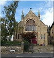
George Street Wesleyan Chapel
The present building is an 1887 replacement for a larger, austere looking building of 1826. The church and the adjacent school house are now converted to private residences.
Image: © Gerald England Taken: 13 Sep 2019
0.03 miles
4
Andrew Arms
A Robinson's pub named after the Andrew family who owned the local land and developed the village. It was originally known as The Commercial Inn and dates from at least 1841. Image
Image: © Gerald England Taken: 13 Sep 2019
0.04 miles
5
Sign of The Andrew Arms
Sign for The Andrew Arms Image
Image: © Gerald England Taken: 13 Sep 2019
0.04 miles
6
Bredbury and Romiley : Montagu Street
In 1804, the Andrew family established a water driven calico printing business at Compstall, downstream from the present mill site. In 1815 Thomas Andrew died, and his son, George Andrew, reorganised the business. He built a water powered cotton mill, and a reservoir to power the wheels, with a steam engine to provide backup power. The first two water wheels, Old Josh and North Wheel were supplemented by the giant Lily Wheel in 1838. This was 17 ft (5.2m) wide and 50 ft (15m) in diameter, and was built by Fairburn and Lillie. The earliest workers cottages had been built on the southern side of the bridge in 1806; in 1823 cottages were built along Market Street on the north side, and this became the heart of the village. With further mills, more houses were added to the north of the village, and by 1839 the village was almost complete.
Image: © Ken Bagnall Taken: 11 Sep 2009
0.04 miles
7
Bredbury and Romiley : Montagu Street
Image: © Ken Bagnall Taken: 11 Sep 2009
0.04 miles
8
The Old School House
Now a residential property on the corner of George Street and John Street.
Image: © Gerald England Taken: 13 Sep 2019
0.04 miles
9
Montague Street
Compstall village street alongside Etherow Country Park.
Image: © Gerald England Taken: 10 Dec 2009
0.04 miles
10
George Street
Looking down to the Post Office and General Store in Market Place, Etherow Country park on the left.
Image: © Peter Teal Taken: 11 Mar 2010
0.04 miles
  • ...