IMAGES TAKEN NEAR TO
Townscliffe Lane, STOCKPORT, SK6 5AR
Introduction
This page details the photographs taken nearby to Townscliffe Lane, SK6 5AR by members of the Geograph project.
The Geograph project started in 2005 with the aim of publishing, organising and preserving representative images for every square kilometre of Great Britain, Ireland and the Isle of Man.

There are currently over 7.5m images from over14,400 individuals and you can help contribute to the project by visiting https://www.geograph.org.uk
Image Map
Images are licensed for reuse under creativecommons.org/licenses/by-sa/2.0
Notes
- Clicking on the map will re-center to the selected point.
- The higher the marker number, the further away the image location is from the centre of the postcode.
Image Listing (11 Images Found)
Images are licensed for reuse under creativecommons.org/licenses/by-sa/2.0
Image
Details
Distance
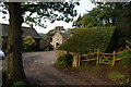
1
Houses at Townscliffe Farm
Now more of a hamlet than a farm
Image: © John Slater
Taken: 9 Aug 2014
0.01 miles
2
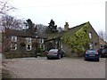
Townscliffe Farm
Grade II listed farmhouse on the outskirts of Marple Bridge. http://list.historicengland.org.uk/resultsingle.aspx?uid=1242492
Image: © Dave Dunford
Taken: 25 Jan 2015
0.02 miles
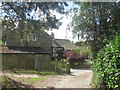
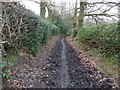
3
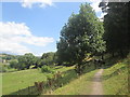
Footpath behind Townscliffe Farm
Leads to Knowle Farm and thence Mellor church.
Image: © Dave Dunford
Taken: 25 Jan 2015
0.05 miles
4
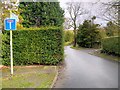
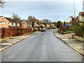
Townscliffe Lane
The lane towards Townscliffe Farm at Mellor
Image: © David Dixon
Taken: 23 Nov 2014
0.06 miles
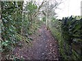
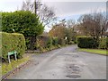
5
Longhurst Lane
Pleasant green lane between Marple Bridge and Mellor.
Image: © Dave Dunford
Taken: 25 Jan 2015
0.08 miles
6
Old farm buildings now used for stables
There is now no farming activity locally apart from the keeping of horses.
Image: © Bill Boaden
Taken: 30 Sep 2010
0.08 miles
8
Footpath towards Mill Brow from Townscliffe farm
Image: © John Slater
Taken: 9 Aug 2014
0.15 miles
9
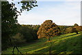
Grazing land between Mellor and Mill Brow
Most of the livestock here is horses.
Image: © Bill Boaden
Taken: 30 Sep 2010
0.23 miles