IMAGES TAKEN NEAR TO
Cornfield Road, STOCKPORT, SK6 4LU
Introduction
This page details the photographs taken nearby to Cornfield Road, SK6 4LU by members of the Geograph project.
The Geograph project started in 2005 with the aim of publishing, organising and preserving representative images for every square kilometre of Great Britain, Ireland and the Isle of Man.

There are currently over 7.5m images from over14,400 individuals and you can help contribute to the project by visiting https://www.geograph.org.uk
Image Map
Images are licensed for reuse under creativecommons.org/licenses/by-sa/2.0
Notes
- Clicking on the map will re-center to the selected point.
- The higher the marker number, the further away the image location is from the centre of the postcode.
Image Listing (36 Images Found)
Images are licensed for reuse under creativecommons.org/licenses/by-sa/2.0
Image
Details
Distance
1
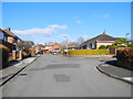
Roundcroft, Romiley
At the junction with Heys Lane.
Image: © John Topping
Taken: 21 Feb 2013
0.06 miles
2
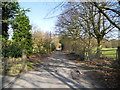
Heys Lane, Romiley
At the point where Heys Lane starts to cross Romiley golf course.
Image: © John Topping
Taken: 21 Feb 2013
0.08 miles
3
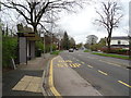
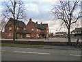
Bus stop and shelter on Compstall Road (B6104)
Looking east.
Image: © JThomas
Taken: 21 Mar 2019
0.10 miles
4
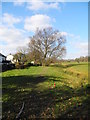
Path behind Green Croft, Romiley
Path leading to Romiley Golf Course Club House (off Barlow Fold Road SJ9491) from Heys Lane.
Image: © John Topping
Taken: 21 Feb 2013
0.10 miles
5
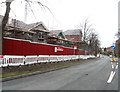
New Housing Development at Cherry Tree
Image: © Anthony Parkes
Taken: 30 Jan 2013
0.11 miles
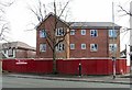
6
Cherry Tree House, Romiley
A modern, purpose-built residential home for the elderly. With the shadow of a tree.
Image: © Neil Theasby
Taken: 18 Oct 2022
0.12 miles
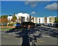
7
New Housing off Cherry Tree Lane
New housing being constructed on the site of the former Cherry Tree pub Image
Image: © Gerald England
Taken: 16 Mar 2013
0.12 miles
8
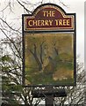
Sign of the Cherry Tree
Sign for the now closed Cherry Tree Image
Image: © Gerald England
Taken: 28 Dec 2011
0.12 miles
9
The Cherry Tree
Large boarded up pub on the junction of Compstall Road and Cherry Tree Lane.
Image: © Gerald England
Taken: 28 Dec 2011
0.12 miles
10
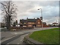
The Cherry Tree
Image: © Gerald England
Taken: 28 Dec 2011
0.12 miles