IMAGES TAKEN NEAR TO
Cromwell Road, STOCKPORT, SK6 2RH
Introduction
This page details the photographs taken nearby to Cromwell Road, SK6 2RH by members of the Geograph project.
The Geograph project started in 2005 with the aim of publishing, organising and preserving representative images for every square kilometre of Great Britain, Ireland and the Isle of Man.

There are currently over 7.5m images from over14,400 individuals and you can help contribute to the project by visiting https://www.geograph.org.uk
Image Map
Images are licensed for reuse under creativecommons.org/licenses/by-sa/2.0
Notes
- Clicking on the map will re-center to the selected point.
- The higher the marker number, the further away the image location is from the centre of the postcode.
Image Listing (24 Images Found)
Images are licensed for reuse under creativecommons.org/licenses/by-sa/2.0
Image
Details
Distance
1
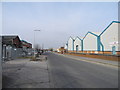
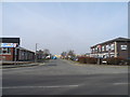
Cromwell Road, Bredbury
Bredbury Park Industrial Estate.
Image: © John Topping
Taken: 4 Mar 2013
0.03 miles
2
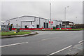
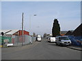
Entrance to Bredbury25 Trade Park
Off Ashton Road. It is named after the motorway junction on the M60. Allied Bakeries have a large plant in the background.
Image: © Bill Boaden
Taken: 24 Jan 2020
0.04 miles
3
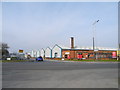
Bredbury Park Industrial Estate
Cromwell Road entrance, off A6017 Ashton Road.
Image: © John Topping
Taken: 4 Mar 2013
0.05 miles
4
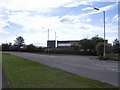
Ashton Road (A6017), Bredbury
Ashton Road in Bredbury, passing Allied Bakeries.
Image: © David Dixon
Taken: 4 Jun 2011
0.08 miles
5
Bredbury Park Industrial Estate
Stuart Road entrance, off A6017 Ashton Road.
Image: © John Topping
Taken: 4 Mar 2013
0.08 miles
6
Far Cromwell Road, Bredbury
Bredbury Park Industrial Estate.
Image: © John Topping
Taken: 4 Mar 2013
0.14 miles
7

Bredbury Park Way
Access to the Industrial Estate.
Image: © Gerald England
Taken: 28 May 2019
0.17 miles
8
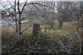
Trig point in Bredbury Park Industrial Estate
This one is now inaccessible behind a fence on land owned by Robinson's Brewery. Triangulation pillars are not used for anything these days, but this one would now be impossible to use.
Image: © Bill Boaden
Taken: 24 Jan 2020
0.18 miles
9
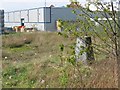
Inaccessible trig pillar.
Locked safely away in Robinson's Brewery, this one has defied all attempts at gaining closer access. This square is almost all industrial estate.
Image: © Richard Webb
Taken: 23 Apr 2004
0.18 miles
10
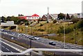
M60 from Brinnington Bridge
Taken from a train crossing over the M60. On the left are the anti-clockwise carriageways. On the right, the clockwise carriageways are about to veer left before sweeping to the right. The wide area between the opposite-flowing carriageways bears witness to the original intention for the motorway to continue Southwards as an A6 bypass.
Image: © Gerald England
Taken: 26 Sep 2009
0.19 miles