IMAGES TAKEN NEAR TO
Burnside Close, STOCKPORT, SK6 2JZ
Introduction
This page details the photographs taken nearby to Burnside Close, SK6 2JZ by members of the Geograph project.
The Geograph project started in 2005 with the aim of publishing, organising and preserving representative images for every square kilometre of Great Britain, Ireland and the Isle of Man.

There are currently over 7.5m images from over14,400 individuals and you can help contribute to the project by visiting https://www.geograph.org.uk
Image Map
Images are licensed for reuse under creativecommons.org/licenses/by-sa/2.0
Notes
- Clicking on the map will re-center to the selected point.
- The higher the marker number, the further away the image location is from the centre of the postcode.
Image Listing (19 Images Found)
Images are licensed for reuse under creativecommons.org/licenses/by-sa/2.0
Image
Details
Distance
1
Play Area, Shakespeare Road, Bredbury
Image: © Alex McGregor
Taken: 23 May 2012
0.12 miles
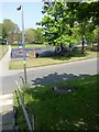
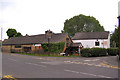
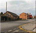
2
Vernon Road
From its junction with Higher Bents Lane.
Image: © Gerald England
Taken: 25 Feb 2010
0.13 miles
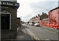
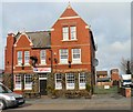
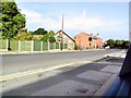
3
The Queens
On the corner of Higher Bents Lane and Vernon Road Image
Image: © Gerald England
Taken: 25 Feb 2010
0.17 miles
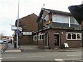
4
The Queens
4 Higher Bents Lane, Bredbury
Image: © David Dixon
Taken: 10 Jun 2010
0.18 miles
5
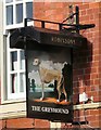
Sign of The Greyhound
The sign for The Greyhound Image on Higher Bents Lane.
Image: © Gerald England
Taken: 25 Feb 2010
0.18 miles
6
The Greyhound
On Lower Bents Lane. Sign Image
Image: © Gerald England
Taken: 25 Feb 2010
0.19 miles
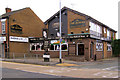
7
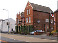
The Greyhound
Lower Bents Lane, Bredbury.
Image: © David Dixon
Taken: 10 Jun 2010
0.19 miles
8
The Barnhouse
Restaurant and Bars on Higher Bents Lane.
Image: © David Dixon
Taken: 10 Jun 2010
0.19 miles
9
Barnhouse Restaurant
On Higher Bents Lane. Photograph taken from the end of Newlyn Drive.
Image: © Gerald England
Taken: 25 Feb 2010
0.20 miles
10
Bredbury Byways
View down Higher Bents Lane past the Barnhouse restaurant towards the centre of Bredbury. The building now known as the restaurant was a farmer's slaughter house - full circle?
Image: © Roger May
Taken: 28 Aug 2005
0.20 miles