IMAGES TAKEN NEAR TO
Alvanley Industrial Estate, Stockport Road, STOCKPORT, SK6 2DJ

Introduction

This page details the photographs taken nearby to Alvanley Industrial Estate, Stockport Road, SK6 2DJ by members of the Geograph project.

The Geograph project started in 2005 with the aim of publishing, organising and preserving representative images for every square kilometre of Great Britain, Ireland and the Isle of Man.

There are currently over 7.5m images from over14,400 individuals and you can help contribute to the project by visiting https://www.geograph.org.uk

Image Map


Images are licensed for reuse under creativecommons.org/licenses/by-sa/2.0
Notes
  • Clicking on the map will re-center to the selected point.
  • The higher the marker number, the further away the image location is from the centre of the postcode.

Image Listing (162 Images Found)

Images are licensed for reuse under creativecommons.org/licenses/by-sa/2.0
  • ...
Image
Details
Distance
1
An overview of Bredbury Curve
A view from the platform crossover bridge showing the lines towards Manchester. On the left is the "Bredbury Curve" which is to be filled in, levelled and used for housing.
Image: © Gerald England Taken: 18 Feb 2017
0.05 miles
2
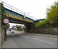
Low bridge over Stockport Road East
The A560 Stockport Road East passes underneath the bridge carrying the New Mills and Manchester railway line near Bredbury Station. The bridge has a height restriction of 4.6m / 15' 6". Beyond the bridge Image it passes over the cutting in which previously ran a line that connected the line from New Mills and Romiley to the Cheshire Lines railway from Godley Junction through Stockport Tiviotdale to Glazebrook. Now that is due to be filled in and housing developed on the land.
Image: © Gerald England Taken: 16 Apr 2016
0.05 miles
3
The Bredbury Curve
Derelict land off Stockport Road East with planning permission for new housing.
Image: © Gerald England Taken: 16 Apr 2016
0.05 miles
4
Stockport Road East
The A560 outside Bredbury Railway Station.
Image: © Gerald England Taken: 12 Nov 2011
0.05 miles
5
Station Close
An appropriate name for the first of the new houses to be completed on the Bredbury Curve development.
Image: © Gerald England Taken: 12 Mar 2019
0.05 miles
6
New houses on the Bredbury Curve development
Viewed from the crossover footbridge at Bredbury Station.
Image: © Gerald England Taken: 30 Aug 2019
0.05 miles
7
New homes under construction
On the Bredbury Curve development.
Image: © Gerald England Taken: 10 May 2018
0.05 miles
8
Northern Rail Class 142, 142038, Bredbury railway station
The train passes over the A560 Stockport Road bridge after passing through Bredbury station. Moving away from the camera towards Manchester, the train is seen from the station footbridge.
Image: © El Pollock Taken: 5 Jun 2015
0.05 miles
9
Towards Manchester, Bredbury railway station
Seen from the station footbridge, the tracks cross over the A560 Stockport Road bridge, nearest to the camera.
Image: © El Pollock Taken: 5 Jun 2015
0.05 miles
10
Low Bridge at Bredbury
The railway bridge carrying the New Mills to Manchester railway over the A560 Stockport Road East has a height restriction of 4.6 m (15' 6").
Image: © Gerald England Taken: 21 Apr 2017
0.05 miles
  • ...