IMAGES TAKEN NEAR TO
Eastbourne Crescent, STOCKPORT, SK5 8BL

Introduction

This page details the photographs taken nearby to Eastbourne Crescent, SK5 8BL by members of the Geograph project.

The Geograph project started in 2005 with the aim of publishing, organising and preserving representative images for every square kilometre of Great Britain, Ireland and the Isle of Man.

There are currently over 7.5m images from over14,400 individuals and you can help contribute to the project by visiting https://www.geograph.org.uk

Image Map


Images are licensed for reuse under creativecommons.org/licenses/by-sa/2.0
Notes
  • Clicking on the map will re-center to the selected point.
  • The higher the marker number, the further away the image location is from the centre of the postcode.

Image Listing (35 Images Found)

Images are licensed for reuse under creativecommons.org/licenses/by-sa/2.0
  • ...
Image
Details
Distance
1
Farmland, Brinnington
Near the M60.
Image: © JThomas Taken: 23 Feb 2013
0.06 miles
2
Path leading to Cromwell Road from Lapwing Lane, Brinnington
Image: © John Topping Taken: 4 Mar 2013
0.08 miles
3
Path leading to Reddish Vale Country Park
This path is situated at the eastern end of Lapwing Lane, Brinnington.
Image: © John Topping Taken: 4 Mar 2013
0.09 miles
4
Brinnington Railway station
With Manchester bound stopping train just arriving, belatedly, from Sheffield.
Image: © Chris Morgan Taken: 23 Jun 2015
0.09 miles
5
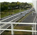
M60 from Brinnington Bridge
Taken from a train crossing over the M60. On the left are the anti-clockwise carriageways. On the right, the clockwise carriageways are about to veer left before sweeping to the right. The wide area between the opposite-flowing carriageways bears witness to the original intention for the motorway to continue Southwards as an A6 bypass.
Image: © Gerald England Taken: 26 Sep 2009
0.09 miles
6
Footbridge over the M60, Brinnington
Viewed on the path leading to Cromwell Road from Lapwing lane.
Image: © John Topping Taken: 4 Mar 2013
0.10 miles
7
M60 from Brinnington Bridge
Taken from a train crossing over the M60. On the left is the anti-clockwise carriageways with a sliproad from the A560 joining. On the right, the clockwise carriageway veers left before sweeping to the right. The wide area between the opposite-flowing carriageways bears witness to the original intention for the motorway to continue Southwards as an A6 bypass.
Image: © Gerald England Taken: 26 Sep 2009
0.10 miles
8
Footbridge over the M60
Footpath leading to Lapwing Lane from Cromwell Road. Bredbury side of footbridge.
Image: © John Topping Taken: 4 Mar 2013
0.11 miles
9
M60 Motorway
Image: © Peter McDermott Taken: 21 Jun 2020
0.11 miles
10
Blackberry Lane, Brinnington
Conway and Ludlow Towers (SJ9193) in the background. Viewed from Lapwing Lane.
Image: © John Topping Taken: 4 Mar 2013
0.12 miles
  • ...