IMAGES TAKEN NEAR TO
Kentstone Avenue, STOCKPORT, SK4 3RE
Introduction
This page details the photographs taken nearby to Kentstone Avenue, SK4 3RE by members of the Geograph project.
The Geograph project started in 2005 with the aim of publishing, organising and preserving representative images for every square kilometre of Great Britain, Ireland and the Isle of Man.

There are currently over 7.5m images from over14,400 individuals and you can help contribute to the project by visiting https://www.geograph.org.uk
Image Map
Images are licensed for reuse under creativecommons.org/licenses/by-sa/2.0
Notes
- Clicking on the map will re-center to the selected point.
- The higher the marker number, the further away the image location is from the centre of the postcode.
Image Listing (21 Images Found)
Images are licensed for reuse under creativecommons.org/licenses/by-sa/2.0
Image
Details
Distance
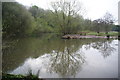
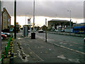
2
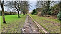
Green space between the housing estates
What is left after the estates have been built but now retained as amenity land.
Image: © Bill Boaden
Taken: 13 Apr 2012
0.06 miles
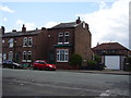
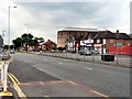
3
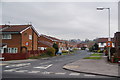
Kentstone Avenue, Burnage
A newer housing development in a large area of residential suburbia.
Image: © Bill Boaden
Taken: 13 Apr 2012
0.09 miles
4
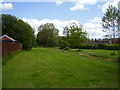
The green divide
An area of green off Burnage lane marks the divide between Stockport and Manchester.
Image: © Anthony Vosper
Taken: 2 Jun 2015
0.11 miles
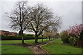
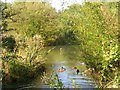
5
Pond on Heaton Mersey Common
A green enclave amogst the housing and now a local nature reserve.
Image: © Bill Boaden
Taken: 13 Apr 2012
0.15 miles
6
Standing alone, Burnage Lane
What appears to have formerly been a shop stands alone next to a row of terraced houses.
Image: © Anthony Vosper
Taken: 6 Jun 2015
0.15 miles
7
Heaton Mersey Common
Pond on Heaton Mersey Common. SJ86279104.
Image: © Keith Williamson
Taken: 5 Oct 2005
0.17 miles
8
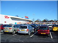
Tesco Supermarket, Burnage
The new Tesco Superstore in Burnage, Manchester. Built within a kilometre of an existing Tesco Superstore !
Image: © David Seale
Taken: 5 Mar 2006
0.18 miles
9
Kingsway, Manchester
Just south of its junction with Lane End Road, looking south west.
Image: © Slbs
Taken: Unknown
0.19 miles
10
Kingsway at Burnage
The A34 out of Manchester.
Image: © Gerald England
Taken: 24 Jun 2010
0.19 miles