IMAGES TAKEN NEAR TO
Lambs Fold, STOCKPORT, SK4 2RF

Introduction

This page details the photographs taken nearby to Lambs Fold, SK4 2RF by members of the Geograph project.

The Geograph project started in 2005 with the aim of publishing, organising and preserving representative images for every square kilometre of Great Britain, Ireland and the Isle of Man.

There are currently over 7.5m images from over14,400 individuals and you can help contribute to the project by visiting https://www.geograph.org.uk

Image Map


Images are licensed for reuse under creativecommons.org/licenses/by-sa/2.0
Notes
  • Clicking on the map will re-center to the selected point.
  • The higher the marker number, the further away the image location is from the centre of the postcode.

Image Listing (19 Images Found)

Images are licensed for reuse under creativecommons.org/licenses/by-sa/2.0
Image
Details
Distance
1
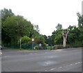
Ash Grove
Image: © Gerald England Taken: 27 May 2022
0.05 miles
2
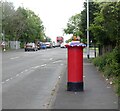
Decorated postbox on Manchester Road
The postbox (SK4 72) on Manchester Road (A6188 formerly A626) has been decorated for the Queen's Platinum Jubilee.
Image: © Gerald England Taken: 27 May 2022
0.11 miles
3
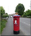
Decorated postbox on Manchester Road
The postbox (SK4 72) on Manchester Road (A6188 formerly A626) has been decorated for the Queen's Platinum Anniversary.
Image: © Gerald England Taken: 27 May 2022
0.11 miles
4
EIIR postbox crowned
The postbox (SK4 72) on Manchester Road ) has been decorated for the Queen's Platinum Anniversary.
Image: © Gerald England Taken: 27 May 2022
0.11 miles
5
EIIR postbox crowned
The postbox (SK4 72) on Manchester Road has been decorated for the Queen's Platinum Anniversary.
Image: © Gerald England Taken: 27 May 2022
0.11 miles
6
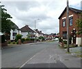
Denby Lane
Image: © Gerald England Taken: 27 May 2022
0.11 miles
7
Hinds Head
The Empress Cinema was built on the site of Ash Farmhouse in 1939. It closed in 1959 after which the old cinema became became the Empress Cabaret Club and other parts of the building were used by the Flamingo Coffee Jive Club. The Empress Bingo Club opened in 1961. In 1967 it was ravaged by fire. It re-opened in 1968 as the Poco a Poco Club and Stockport Casino. In 1983 it became Chesters and in 1987 it was demolished following a fire. The Hinds Head, originally a Whitbread pub, was built on the site and set back from Manchester Road. It became a free house in 2007. For a more detailed history see http://shawweb.myzen.co.uk/stephen/poco.htm Image
Image: © Gerald England Taken: 27 May 2022
0.12 miles
8
Hinds Head
The Hinds Head public house.
Image: © Peter McDermott Taken: 16 May 2021
0.13 miles
9
Sign of the Hinds Head
Sign for the Hinds Head Image
Image: © Gerald England Taken: 27 May 2022
0.13 miles
10
Wellington Road North (A6)
Looking southwards, towards Stockport, along the A6 (Wellington Road North) at Heaton Chapel.
Image: © David Dixon Taken: 13 Apr 2011
0.18 miles