IMAGES TAKEN NEAR TO
Clement Street, STOCKPORT, SK4 1QN
Introduction
This page details the photographs taken nearby to Clement Street, SK4 1QN by members of the Geograph project.
The Geograph project started in 2005 with the aim of publishing, organising and preserving representative images for every square kilometre of Great Britain, Ireland and the Isle of Man.

There are currently over 7.5m images from over14,400 individuals and you can help contribute to the project by visiting https://www.geograph.org.uk
Image Map
Images are licensed for reuse under creativecommons.org/licenses/by-sa/2.0
Notes
- Clicking on the map will re-center to the selected point.
- The higher the marker number, the further away the image location is from the centre of the postcode.
Image Listing (89 Images Found)
Images are licensed for reuse under creativecommons.org/licenses/by-sa/2.0
Image
Details
Distance
1
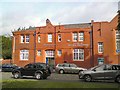
Belmont House
Belmont House was originally a United Reformed Church and designated a "building of local historic interest". It needed extensive renovations and was bought by the School of Practical Philosophy in 2004. Students in the School together with professional craftsmen dedicated many hours to the restoration of the wonderful building to its present high standard. http://web.archive.org/web/20120904092936/http://www.practicalphilosophy.co.uk/links/
It also houses St James' Independent Primary School, a day school for http://web.archive.org/web/20120904172942/http://www.stjamesschool.org.uk/
Note: Photograph is for record purposes only and the description refers to the situation at the time the photograph was taken.
Image: © Gerald England
Taken: 10 Sep 2012
0.08 miles
2
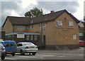
The Silver Jubilee
The Robinson's pub the Silver Jubilee, as the name suggests was built in 1977 on the site of an earlier hostelry which was demolished to make way for the adjacent shopping centre.
Image: © Gerald England
Taken: 10 Sep 2012
0.09 miles
3
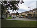
Oxford Way
Viewed from across Belmont Way to which it has no direct access.
Image: © Gerald England
Taken: 10 Sep 2012
0.12 miles
4
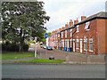
Lloyd Street
From the corner of Cotswold Road and Malvern Close.
Image: © Gerald England
Taken: 24 Aug 2013
0.12 miles
5
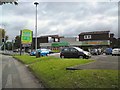
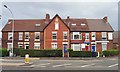
Asda and Farmfoods
Small shopping centre off Belmont Way.
Image: © Gerald England
Taken: 10 Sep 2012
0.12 miles
6
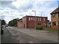
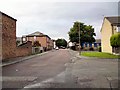
Short Street
The building on the right is the Salvation Army, Heaton Norris Community Church. http://web.archive.org/web/20130614164602/http://salvationarmyheatonnorris.com/
Image: © Gerald England
Taken: 31 Aug 2013
0.13 miles
7
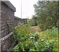
Rails to Denton
The side of the bridge on Wellington Road North over the railway line from Stockport to Denton. The line is primarily used for freight but carries one passenger train per week in one direction only Image
Image: © Gerald England
Taken: 7 Jul 2009
0.13 miles
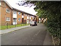
10
Hampden Place
A group of houses on Wellington Road North bearing a date stone of 1862 Image
Image: © Gerald England
Taken: 24 Aug 2013
0.15 miles