IMAGES TAKEN NEAR TO
Cheviot Close, STOCKPORT, SK4 1JW

Introduction

This page details the photographs taken nearby to Cheviot Close, SK4 1JW by members of the Geograph project.

The Geograph project started in 2005 with the aim of publishing, organising and preserving representative images for every square kilometre of Great Britain, Ireland and the Isle of Man.

There are currently over 7.5m images from over14,400 individuals and you can help contribute to the project by visiting https://www.geograph.org.uk

Image Map


Images are licensed for reuse under creativecommons.org/licenses/by-sa/2.0
Notes
  • Clicking on the map will re-center to the selected point.
  • The higher the marker number, the further away the image location is from the centre of the postcode.

Image Listing (102 Images Found)

Images are licensed for reuse under creativecommons.org/licenses/by-sa/2.0
  • ...
Image
Details
Distance
1
Lloyd Street
From the corner of Cotswold Road and Malvern Close.
Image: © Gerald England Taken: 24 Aug 2013
0.03 miles
2
Hampden Place
A group of houses on Wellington Road North bearing a date stone of 1862 Image
Image: © Gerald England Taken: 24 Aug 2013
0.04 miles
3
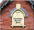
Hampden Place 1862
Name and date stone on Hampden Place Image
Image: © Gerald England Taken: 24 Aug 2013
0.04 miles
4
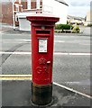
GR postbox SK4 61
GR postbox SK4 61 on Wellington Road North. It is inscribed at the base CARRON COMPANY STIRLINGSHIRE
Image: © Gerald England Taken: 24 Aug 2013
0.05 miles
5
Hope Inn
At the corner of Wellington Road North and Lloyd Street. Image
Image: © Gerald England Taken: 7 Jul 2009
0.05 miles
6
Malvern Close
From Belmont Road.
Image: © Gerald England Taken: 24 Aug 2013
0.06 miles
7
Hope Inn
The mid nineteenth-century public house is locally listed (link no longer available). Red brick, slate roof, symmetrical front to Wellington Road North. Five-window range, the windows with partial or wholly replacement multipaned glazing detail beneath flat heads of gauged brick. Central door with arched head and plain fanlight. Brick parapet with a central segmental gablet which has the words :- HOPE INN flanked by the words:- HARDY'S CROWN ALES on each side in gold mosaic on a blue mosaic ground. The elevation to Lloyd Street has similar lettering in the parapet. The building probably corresponds with one in the same position shown on the 1848 6":1 mile OS map.
Image: © Gerald England Taken: 24 Aug 2013
0.07 miles
8
The Hope
The locally-listed building on Wellington Road North, the A6, dates back to at least 1848 Image Originally it was tied to Hardy's Crown Ales who were acquired by Bass. In 2011 it was closed and for sale Image It was bought by Martin Wood and opened as a speciality freehouse in 2013. It has a micro-brewery producing cask and bottle ales under the name Fool Hardy Ales. Image
Image: © Gerald England Taken: 10 Jun 2019
0.07 miles
9
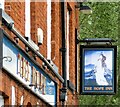
Sign of The Hope Inn
Sign for The Hope Image
Image: © Gerald England Taken: 10 Jun 2019
0.07 miles
10
The Hope
The locally-listed building on Wellington Road North, the A6, dates back to at least 1848 Image Originally it was tied to Hardy's Crown Ales who were acquired by Bass. In 2011 it was closed and for sale Image It was bought by Martin Wood and opened as a speciality freehouse in 2013 http://www.thehopestockport.co.uk/ It had a micro-brewery producing cask and bottle ales under the name Fool Hardy Ales. Now it is for sale again.
Image: © Gerald England Taken: 17 Sep 2022
0.07 miles
  • ...