IMAGES TAKEN NEAR TO
Stanbank Street, SK4 1DA

Introduction

This page details the photographs taken nearby to Stanbank Street, SK4 1DA by members of the Geograph project.

The Geograph project started in 2005 with the aim of publishing, organising and preserving representative images for every square kilometre of Great Britain, Ireland and the Isle of Man.

There are currently over 7.5m images from over14,400 individuals and you can help contribute to the project by visiting https://www.geograph.org.uk

Image Map


Images are licensed for reuse under creativecommons.org/licenses/by-sa/2.0
Notes
  • Clicking on the map will re-center to the selected point.
  • The higher the marker number, the further away the image location is from the centre of the postcode.

Image Listing (35 Images Found)

Images are licensed for reuse under creativecommons.org/licenses/by-sa/2.0
  • ...
Image
Details
Distance
1
Converted chapel
The former Bethesda Primitive Methodist Chapel (the name engraved above the door) is now the home of a provider of power tools.
Image: © Graham Hogg Taken: 16 Dec 2011
0.05 miles
2
Christ with All Saints, Heaton Norris
The foundation stone of All Saints Church Heaton Norris, designed by Stockport and Manchester architects Preston and Vaughan, was laid by Lady Egerton of Tatton (who had provided the land) in 1886, and the building was completed two years later. The building is in the Gothic revival style typical of the architect's other local churches such as St. Augustine, Cheadle Heath, St. Andrew, Levenshulme (both now closed) and St. Alban, Offerton. It consists of yellow brick with red brick dressings. The parish was carved out of a portion of that of Christ Church Heaton Norris, of which only the spire remains. The church was renovated in 1991. http://www.cwas.org.uk/?page_id=14
Image: © Gerald England Taken: 27 May 2022
0.07 miles
3
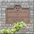
Christ with All Saints, Heaton Norris: Foundation Stone
Foundation Stone for Christ with All Saints Image
Image: © Gerald England Taken: 27 May 2022
0.07 miles
4
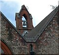
Christ with All Saints, Heaton Norris: Bellcote
Image: © Gerald England Taken: 27 May 2022
0.07 miles
5
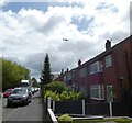
Manchester Road
Formerly the A626 but now renumbered as A6188. Overhead a plane is approaching Manchester Airport.
Image: © Gerald England Taken: 27 May 2022
0.08 miles
6
Manchester Road Post Office
Part of the LOCO grocery store. This was previously R & B Stores. Horace Grove on the left is a one-way street.
Image: © Gerald England Taken: 27 May 2022
0.10 miles
7
Lloyd Street
Image: © Gerald England Taken: 27 May 2022
0.15 miles
8
South Reddish from the air
Viewed from above Stockport.
Image: © Thomas Nugent Taken: 18 Sep 2024
0.17 miles
9
The Ash Hotel 1901
Architectural detail on the Ash Hotel Image
Image: © Gerald England Taken: 27 May 2022
0.18 miles
10
Ash Hotel
A former Wilson's Brewery house dating from 1901 Image it was converted into The Ash Tea Rooms in 2011. It is now undergoing conversion into apartments.
Image: © Gerald England Taken: 27 May 2022
0.18 miles
  • ...