IMAGES TAKEN NEAR TO
Ealing Road, STOCKPORT, SK3 9PX

Introduction

This page details the photographs taken nearby to Ealing Road, SK3 9PX by members of the Geograph project.

The Geograph project started in 2005 with the aim of publishing, organising and preserving representative images for every square kilometre of Great Britain, Ireland and the Isle of Man.

There are currently over 7.5m images from over14,400 individuals and you can help contribute to the project by visiting https://www.geograph.org.uk

Image Map


Images are licensed for reuse under creativecommons.org/licenses/by-sa/2.0
Notes
  • Clicking on the map will re-center to the selected point.
  • The higher the marker number, the further away the image location is from the centre of the postcode.

Image Listing (61 Images Found)

Images are licensed for reuse under creativecommons.org/licenses/by-sa/2.0
  • ...
Image
Details
Distance
1
Brinksway
The A560 towards Cheadle Heath from Stockport.
Image: © Gerald England Taken: 6 Apr 2011
0.08 miles
2
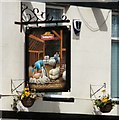
Sign of Ye Olde Woolpack
Sign for Ye Olde Woolpack Image
Image: © Gerald England Taken: 6 Apr 2011
0.08 miles
3
Ye Olde Woolpack
On Brinksway. Image
Image: © Gerald England Taken: 6 Apr 2011
0.08 miles
4
Brinksway Shelter
Next to the modern bus stop on Brinksway near Ye Olde Woolpack Image is an old shelter in front of an electricity sub station. I don't think it is a bus shelter as it is angled away from the direction in which buses from Cheadle will be coming (currently only one an hour, the #312). Perhaps the layout of the roads was different before the building of the motorway nearby.
Image: © Gerald England Taken: 6 Apr 2011
0.08 miles
5
Kings Reach from Hollywood Park
Looking from Hollywood Park over the Community Orchard Image towards Kings Reach and the "Pyramid" Image
Image: © Gerald England Taken: 9 Feb 2016
0.09 miles
6
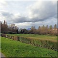
Hollywood Park Community Orchard
One of 12 community orchards in Stockport http://www.stockport.gov.uk/services/transport/highwayandstreetlightmaintenance/trees/communityorchards/ established around 2011. I was told by a passing dog-walker that it was originally a bowling green. Aerial views would seem to indicate that it was once a football pitch. It looks rather neglected but that may be just the time of year.
Image: © Gerald England Taken: 9 Feb 2016
0.10 miles
7
Hollywood Way Bridge, Stockport
Image: © Chris Morgan Taken: 3 Sep 2020
0.10 miles
8
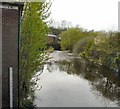
River Mersey
Downstream from Kings Reach. Note the flood level gauge on the left.
Image: © Gerald England Taken: 6 Apr 2011
0.10 miles
9
Hollywood Way Bridge.
The bridge carrying Hollywood Way over the River Mersey in Stockport. SJ88519005
Image: © Keith Williamson Taken: 21 Sep 2005
0.11 miles
10
River Mersey, Stockport
Looking downstream from close to King's Valley, Stockport, not far from where the Rivers Tame and Goyt joined to form the Mersey near Stockport town centre Image SJ88499005.
Image: © Keith Williamson Taken: 21 Sep 2005
0.11 miles
  • ...