1
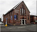
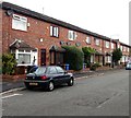
Town House, Hope Terrace, Stockport
A red and white horizontal barrier is across the Thomson Street end of Hope Terrace.
The name above the white doors is TOWN HOUSE.
Image: © Jaggery
Taken: 10 Sep 2016
0.01 miles
2
Stockport Baptist Church
Image: © Alexander P Kapp
Taken: 5 May 2009
0.01 miles
3
Stockport Baptist Church
Greek Street Baptist Chapel http://www.stockportbaptist.org/about-us/ was built in a Romanesque style around 1869 with a capacity to seat 800 people. It was the largest Baptist church in Greater Manchester, and stood in the centre of a busy residential area.
By the 1970s, however, Greek Street Chapel was no longer viable financially, requiring large amounts of maintenance, and was demolished in 1978. It is because of this building that the church is still known as Greek Street Baptist Church by many people in Stockport, even though the present church building is behind Greek Street on Thomson Street.
The present church building was originally the church hall or Sunday school. It was newly refurbished in 2003/4.
Image: © Gerald England
Taken: 31 Jul 2012
0.01 miles
4
Stockport Baptist Church, Stockport
Viewed across Thomson Street. The church website records that Stockport's first Baptist, Peter Longworth, was baptised in the canal near Lancashire Bridge on Sunday morning July 29th 1838 in the presence of 1,000 people. Stockport Baptist Church was founded in 1838 with a minister and eight members. The current church building seen here in September 2016 was originally the church hall/Sunday School.
Image: © Jaggery
Taken: 10 Sep 2016
0.01 miles
5
Stockport Baptist Church, Stockport
Viewed across Thomson Street from the corner of Armoury Street.
The church website records that Stockport's first Baptist, Peter Longworth, was baptised in the canal near Lancashire Bridge on Sunday morning July 29th 1838 in the presence of 1,000 people. Stockport Baptist Church was founded in 1838 with a minister and eight members. The current church building seen here in September 2016 was originally the church hall/Sunday School.
Image: © Jaggery
Taken: 10 Sep 2016
0.02 miles
6
Stockport NCP car park
A fairly new facility, being opened in 2014 according to another reliable Geograph contributor
Image
Image: © Stephen Craven
Taken: 17 Apr 2016
0.02 miles
7
Row of brick houses, Thomson Street, Stockport
Viewed from opposite Stockport Baptist Church. http://www.geograph.org.uk/photo/5114320
Image: © Jaggery
Taken: 10 Sep 2016
0.03 miles
8
Nixon Street, Stockport
Viewed across Blackshaw Street. Double yellow lines on both sides indicate no parking at any time.
Image: © Jaggery
Taken: 10 Sep 2016
0.04 miles
9
Grindrod House, Stockport
The Blackshaw Street side of Grindrod House on the corner of Thomson Street.
Image: © Jaggery
Taken: 10 Sep 2016
0.04 miles
10
Danger - razor wire, Armoury Street, Stockport
Razor wire tops the Armoury Street entrance gates to an Army Reserve Centre.
Image: © Jaggery
Taken: 10 Sep 2016
0.04 miles


