IMAGES TAKEN NEAR TO
Blaven Close, STOCKPORT, SK3 8RT

Introduction

This page details the photographs taken nearby to Blaven Close, SK3 8RT by members of the Geograph project.

The Geograph project started in 2005 with the aim of publishing, organising and preserving representative images for every square kilometre of Great Britain, Ireland and the Isle of Man.

There are currently over 7.5m images from over14,400 individuals and you can help contribute to the project by visiting https://www.geograph.org.uk

Image Map


Images are licensed for reuse under creativecommons.org/licenses/by-sa/2.0
Notes
  • Clicking on the map will re-center to the selected point.
  • The higher the marker number, the further away the image location is from the centre of the postcode.

Image Listing (26 Images Found)

Images are licensed for reuse under creativecommons.org/licenses/by-sa/2.0
  • ...
Image
Details
Distance
1
Davenport Station car park
Image: © N Chadwick Taken: 29 Oct 2014
0.12 miles
2
Cale Green Park toilets
Toilet block in Cale Green Park.
Image: © Gerald England Taken: 7 Sep 2021
0.15 miles
3
Cale Green Park
Near the centre of the square
Image: © Chris Shaw Taken: Unknown
0.19 miles
4
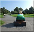
Resilience Frog
Located in Cale Green Park, Resilience Frog represents Davenport and Cale Green Ward. Sponsored by Stephensons it is one of 17 frogs taking up residence in wards across Stockport Borough in addition to the 21 frogs across the town centre. as part of Stockport's Gigantic Leap Frog Art Trail.
Image: © Gerald England Taken: 7 Sep 2021
0.19 miles
5
Davenport Station, Bramhall Lane
Suburban station on line to Stockport and Manchester Piccadilly.
Image: © Peter Barr Taken: 15 Feb 2013
0.20 miles
6
Davenport station
View towards Stockport.
Image: © Peter Whatley Taken: 25 Jan 2013
0.20 miles
7
Bridge at Davenport Station
The bridge carrying the A5102 (Bramhall Lane) over the railway at Davenport Station.
Image: © David Dixon Taken: 24 Aug 2011
0.20 miles
8
Davenport Station
Davenport is a residential suburb on the outskirts of Stockport. It takes its name from its railway station, itself named after the Davenport family which for centuries lived at Bramhall Hall. When the railway came to the area in the 1850s in the shape of the Stockport, Disley and Whaley Bridge line, there was no settlement here; it was just a remote corner of the Davenport family's estate. However, the Davenports had ideas of developing this part of their land as a residential suburb. The station was built at the point where the Stockport to Bramhall road crossed the railway; although the station was not actually built in time for the opening of the line in 1857, but the following year, 1858 after complaints from the Davenports that a station had been promised. It was named Davenport after its sponsors. Not long afterwards, however, the Davenports sold all their land, including what is now Davenport, much of it to a property company, and moved away from the area. A few large houses were constructed around the station in its early years, several of them to be occupied by moguls of the hatting and cotton-spinning industries for which Stockport is famous. The now-familiar station booking office is not an original feature but dates from the 1880s. A photo of the station circa 1910 is in the Manchester Archive's Flickr collection http://www.flickr.com/photos/manchesterarchiveplus/5258228605/ More information on the station and its environs can be found on the Davenport Station website. http://www.davenportstation.org.uk/
Image: © Gerald England Taken: 30 Jan 2014
0.21 miles
9
Resilience Frog
Located in Cale Green Park, Resilience Frog represents Davenport and Cale Green Ward. Sponsored by Stephensons it is one of 17 frogs taking up residence in wards across Stockport Borough in addition to the 21 frogs across the town centre. as part of Stockport's Gigantic Leap Frog Art Trail.
Image: © Gerald England Taken: 7 Sep 2021
0.21 miles
10
Davenport station building
Image: © Peter Whatley Taken: 29 Oct 1988
0.21 miles
  • ...