IMAGES TAKEN NEAR TO
Simpson Street, STOCKPORT, SK3 8GF

Introduction

This page details the photographs taken nearby to Simpson Street, SK3 8GF by members of the Geograph project.

The Geograph project started in 2005 with the aim of publishing, organising and preserving representative images for every square kilometre of Great Britain, Ireland and the Isle of Man.

There are currently over 7.5m images from over14,400 individuals and you can help contribute to the project by visiting https://www.geograph.org.uk

Image Map


Images are licensed for reuse under creativecommons.org/licenses/by-sa/2.0
Notes
  • Clicking on the map will re-center to the selected point.
  • The higher the marker number, the further away the image location is from the centre of the postcode.

Image Listing (629 Images Found)

Images are licensed for reuse under creativecommons.org/licenses/by-sa/2.0
  • ...
Image
Details
Distance
1
St Thomas' Hospital
From Royal George Street.
Image: © Gerald England Taken: 24 Feb 2014
0.02 miles
2
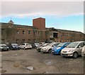
Stockport College Car Park
Behind the car park of Stockport College are the derelict buildings of the former St Thomas' Hospital. The site belongs to the college but their plans to convert the site into student accommodation and other educational purposes have failed to reach fruition.
Image: © Gerald England Taken: 24 Feb 2014
0.03 miles
3
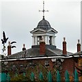
Workhouse Cupola and weather vane
Viewed from Royal George Street Image
Image: © Gerald England Taken: 24 Feb 2014
0.03 miles
4
Stockport College Carpark
In the background is the former St Thomas' Hospital which was acquired by the college in 2003 as part of their still to be executed expansion plans.
Image: © Gerald England Taken: 10 Feb 2014
0.03 miles
5
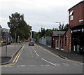
Flint Street, Stockport
Viewed across the B5465 Shaw Heath.
Image: © Jaggery Taken: 10 Sep 2016
0.03 miles
6
Flint Street, Stockport
Dead end street on the northeast side of the B5465 Shaw Heath.
Image: © Jaggery Taken: 10 Sep 2016
0.03 miles
7
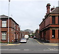
Royal George Street, Stockport
Viewed across Greek Street. Double yellow lines on both sides indicate no parking at any time. Sandwich Corner http://www.geograph.org.uk/photo/5112597 is on the right. The car is about to turn left into Oliver Street.
Image: © Jaggery Taken: 10 Sep 2016
0.04 miles
8
Royal George Street
The middle section of Royal George Street is reduced to a footpath. On the left is Stockport College. On the right is the former St Thomas's Hospital.
Image: © Gerald England Taken: 24 Feb 2014
0.04 miles
9
Greek Street, Stockport
Looking northeast along Greek Street past the edge of the Army Reserve Centre.
Image: © Jaggery Taken: 10 Sep 2016
0.05 miles
10
Our Lady And The Apostles Catholic Church, Stockport
Image: © Alexander P Kapp Taken: 5 May 2009
0.05 miles
  • ...