IMAGES TAKEN NEAR TO
Randolph Place, STOCKPORT, SK3 8EJ

Introduction

This page details the photographs taken nearby to Randolph Place, SK3 8EJ by members of the Geograph project.

The Geograph project started in 2005 with the aim of publishing, organising and preserving representative images for every square kilometre of Great Britain, Ireland and the Isle of Man.

There are currently over 7.5m images from over14,400 individuals and you can help contribute to the project by visiting https://www.geograph.org.uk

Image Map


Images are licensed for reuse under creativecommons.org/licenses/by-sa/2.0
Notes
  • Clicking on the map will re-center to the selected point.
  • The higher the marker number, the further away the image location is from the centre of the postcode.

Image Listing (316 Images Found)

Images are licensed for reuse under creativecommons.org/licenses/by-sa/2.0
  • ...
Image
Details
Distance
1
Shaw Heath directions sign, Stockport
Facing northbound traffic on the B5465 Shaw Heath. Ahead for Stockport town centre and Manchester or left for Cheadle.
Image: © Jaggery Taken: 10 Sep 2016
0.02 miles
2
Shaw Heath
Part of the B5465 which forms a southern bypass around Stockport linking the A560 to the A6. On the right, behind the white wall, lies the abandoned St Thomas' Hospital. On the corner is a gatepost Image to the Hollands Mill, demolished in 2007, the site of which is behind the photographer.
Image: © Gerald England Taken: 10 Feb 2014
0.03 miles
3
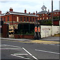
Depiction of two redcoat soldiers on a Shaw Heath corner, Stockport
Two soldiers, each wearing a red tunic and black bearskin, are depicted on a gatepost outside the site of the demolished former Hollands Mill. The long derelict former St Thomas's Hospital is in the background.
Image: © Jaggery Taken: 10 Sep 2016
0.03 miles
4
St Thomas's Hospital
In 2015 vandals gained entry to the site and several buildings were damaged by fire. Since then the site has been secured with anti-vandal fencing topped with barbed wire.
Image: © Gerald England Taken: 22 Aug 2015
0.03 miles
5
Hollands Mill gate post
This decorated gatepost Image is all that is left of Hollands Mill which was demolished in 2007. The electricity substation behind is in the grounds of the former St Thomas' Hospital Image
Image: © Gerald England Taken: 10 Feb 2014
0.03 miles
6
Shaw Heath electricity substation, Stockport
Electricity North West electricity substation viewed across the B5465 Shaw Heath.
Image: © Jaggery Taken: 10 Sep 2016
0.03 miles
7
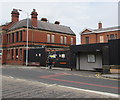
Shaw Heath bus shelter, Stockport
Between the B5465 Shaw Heath and the fenced-off former St Thomas's Hospital which closed down in 2004.
Image: © Jaggery Taken: 10 Sep 2016
0.04 miles
8
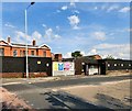
Fenced-off former hospital site, Shaw Heath, Stockport
Part of the former St Thomas's Hospital which closed down in 2004, viewed across the B5465 Shaw Heath in September 2016.
Image: © Jaggery Taken: 10 Sep 2016
0.04 miles
9
Stockport NHS Dialysis Unit, Shaw Heath, Stockport
Text on the board above the name shows Central Manchester University Hospitals NHS Foundation Trust FRESENIUS MEDICAL CARE
Image: © Jaggery Taken: 10 Sep 2016
0.04 miles
10
Hollands Mill Gatepost
A gatepost Image on Shaw Heath Image at the entrance to Hollands Mill. The mill was demolished in 2007.
Image: © Gerald England Taken: 10 Feb 2014
0.04 miles
  • ...