IMAGES TAKEN NEAR TO
Spectrum Way, STOCKPORT, SK3 0SA

Introduction

This page details the photographs taken nearby to Spectrum Way, SK3 0SA by members of the Geograph project.

The Geograph project started in 2005 with the aim of publishing, organising and preserving representative images for every square kilometre of Great Britain, Ireland and the Isle of Man.

There are currently over 7.5m images from over14,400 individuals and you can help contribute to the project by visiting https://www.geograph.org.uk

Image Map


Images are licensed for reuse under creativecommons.org/licenses/by-sa/2.0
Notes
  • Clicking on the map will re-center to the selected point.
  • The higher the marker number, the further away the image location is from the centre of the postcode.

Image Listing (17 Images Found)

Images are licensed for reuse under creativecommons.org/licenses/by-sa/2.0
Image
Details
Distance
1
Business park on Spectrum Way
These units are the home of UK Biobank, a major national health resource with the aim of improving the prevention, diagnosis and treatment of a wide range of serious and life-threatening illnesses. See http://www.ukbiobank.ac.uk/about-biobank-uk/ for more information.
Image: © Graham Hogg Taken: 25 Feb 2013
0.05 miles
2
UK Biobank
UK Biobank is a large long-term biobank study in the United Kingdom (UK) which is investigating the respective contributions of genetic predisposition and environmental exposure (including nutrition, lifestyle, medications etc.) to the development of disease. It began in 2007. https://en.wikipedia.org/wiki/UK_Biobank and http://www.ukbiobank.ac.uk . The large gas cylinders point to the presence of many scanners requiring supercooling.
Image: © David Lally Taken: 2 Feb 2016
0.06 miles
3
Stockport Police Station
On Spectrum Way, part of a developing business estate to the south west of the town centre.
Image: © David Lally Taken: 2 Feb 2016
0.07 miles
4
Manchester Paper Box
Factory on Birdhall Lane.
Image: © Gerald England Taken: 6 Aug 2012
0.14 miles
5
Open ground, Adswood from the air
There appears to be a BMX track and a football pitch.
Image: © Thomas Nugent Taken: 19 Oct 2018
0.14 miles
6
Europa Business Park
One of the many commercial estates off Birdhall Lane.
Image: © Bill Boaden Taken: 8 Oct 2013
0.16 miles
7
A unit on Hercules Office Park
This one looks empty.
Image: © Bill Boaden Taken: 8 Oct 2013
0.17 miles
8
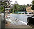
Bus stop on Birdhall Lane
Whilst most vehicles driving past were far enough into the road to miss the puddle by the bus stop, about one in ten drove close enough to hit more than the edge of puddle sending a huge splash of water straight into the bus shelter, which is why I was here taking this photograph rather than standing in the shelter having been showered twice.
Image: © Gerald England Taken: 6 Aug 2012
0.17 miles
9
Vacant Warehousing
A huge vacant plot on Birdhall Lane previously occupied by the distribution warehouses of Fowler Welch.
Image: © Gerald England Taken: 6 Aug 2012
0.17 miles
10
The eastern edge of Hercules Office Park
The development continues onto the more industrial Orion Business Park next door.
Image: © Bill Boaden Taken: 8 Oct 2013
0.18 miles