IMAGES TAKEN NEAR TO
Chestergate, STOCKPORT, SK3 0BD

Introduction

This page details the photographs taken nearby to Chestergate, SK3 0BD by members of the Geograph project.

The Geograph project started in 2005 with the aim of publishing, organising and preserving representative images for every square kilometre of Great Britain, Ireland and the Isle of Man.

There are currently over 7.5m images from over14,400 individuals and you can help contribute to the project by visiting https://www.geograph.org.uk

Image Map


Images are licensed for reuse under creativecommons.org/licenses/by-sa/2.0
Notes
  • Clicking on the map will re-center to the selected point.
  • The higher the marker number, the further away the image location is from the centre of the postcode.

Image Listing (125 Images Found)

Images are licensed for reuse under creativecommons.org/licenses/by-sa/2.0
  • ...
Image
Details
Distance
1
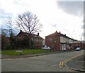
Lottery Street
Off Hardman Street.
Image: © Gerald England Taken: 9 Feb 2016
0.05 miles
2
Park View Resource Centre
Park View Resource Centre is run by Headway Stockport & South Manchester and provides a drop-in session for survivors of brain injury, their family and carers.
Image: © Gerald England Taken: 9 Feb 2016
0.06 miles
3
Hollywood Park Centre
The Hollywood Park Centre formerly Hollywood Park Council School on Hardman Street is Grade II listed http://www.britishlistedbuildings.co.uk/en-503225-hollywood-park-centre- It was built as a junior and senior school in 1906 by Cheers & Smith of Blackburn and Twickenham. It is now shared between a combined nursery centre and the Stopford Open Learning Centre.
Image: © Gerald England Taken: 9 Feb 2016
0.08 miles
4
Converted mill, Stockport
Adjacent to the River Mersey and close to the city centre, the mill is now a self-storage facility.
Image: © Graham Hogg Taken: 21 Sep 2010
0.09 miles
5
Hollywood Park Community Orchard
One of 12 community orchards in Stockport http://www.stockport.gov.uk/services/transport/highwayandstreetlightmaintenance/trees/communityorchards/ established around 2011. I was told by a passing dog-walker that it was originally a bowling green. Aerial views would seem to indicate that it was once a football pitch. It looks rather neglected but that may be just the time of year.
Image: © Gerald England Taken: 9 Feb 2016
0.10 miles
6
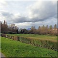
Towards Heaton Norris from Hollywood Park
Looking from Hollywood Park over the Community Orchard towards Heaton Norris. On the skyline is Christ Church Image and to the left is the B&Q Image store.
Image: © Gerald England Taken: 9 Feb 2016
0.11 miles
7
Kings Reach from Hollywood Park
Looking from Hollywood Park over the Community Orchard Image towards Kings Reach and the "Pyramid" Image
Image: © Gerald England Taken: 9 Feb 2016
0.11 miles
8
Trans Pennine Trail
The cycle trail leaving Stockport town centre sandwiched between the River Mersey and at this point a slip road of the M60 motorway.
Image: © Kevin Waterhouse Taken: 19 Jul 2024
0.12 miles
9
Milepost on the Trans Pennine Trail
This coast-to-coast trail between Southport and Hornsea is 215 miles long.
Image: © Graham Hogg Taken: 21 Sep 2010
0.12 miles
10
By the way
Trans Pennine Trail, nearing Stockport, 19 miles from Lymm. National Cycle Network, Route 62
Image: © Chris Morgan Taken: 3 Sep 2020
0.12 miles
  • ...