IMAGES TAKEN NEAR TO
Chapel-en-le-Frith, HIGH PEAK, SK23 9UF

Introduction

This page details the photographs taken nearby to SK23 9UF by members of the Geograph project.

The Geograph project started in 2005 with the aim of publishing, organising and preserving representative images for every square kilometre of Great Britain, Ireland and the Isle of Man.

There are currently over 7.5m images from over14,400 individuals and you can help contribute to the project by visiting https://www.geograph.org.uk

Image Map


Images are licensed for reuse under creativecommons.org/licenses/by-sa/2.0
Notes
  • Clicking on the map will re-center to the selected point.
  • The higher the marker number, the further away the image location is from the centre of the postcode.

Image Listing (9 Images Found)

Images are licensed for reuse under creativecommons.org/licenses/by-sa/2.0
Image
Details
Distance
1
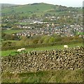
View from Martinside
Looking over Chapel towards Eccles Pike Image
Image: © Alan Murray-Rust Taken: 25 Oct 2015
0.13 miles
2
Footpath from Martinside
At the summit of Long Lane, just west of Martinside, this footpath descends into Chapel en le Frith via Eaves Hall after crossing the railway. The stone step stiles in the walls are superfluous now that the gate has vanished.
Image: © Roger May Taken: 11 Dec 2005
0.20 miles
3
Water Meadow near Eaves Hall
Image: © Jonathan Clitheroe Taken: 13 Mar 2014
0.21 miles
4
Sunny wintry day
View from office window at Martinside
Image: © Bob Abell Taken: Unknown
0.21 miles
5
Paradise Farm
Image: © Graham Hogg Taken: 22 Aug 2017
0.22 miles
6
Piece Farm Cottage, Martinside
Image: © Neil Theasby Taken: 16 Apr 2021
0.23 miles
7
View from Martinside
Nearer, the roofs of Martinside House; beyond is Chapel-en-le-Frith railway station.
Image: © Alan Murray-Rust Taken: 25 Oct 2015
0.24 miles
8
Near Hollinknoll, Chapel-en-le-Frith
Image: © Chris Wimbush Taken: 29 Mar 2009
0.24 miles
9
Long Lane, cattle and Chapel-en-le-Frith
Image: © Peter Barr Taken: 31 Aug 2010
0.24 miles