1
A corner of Chapel-en-le-Frith churchyard
Image: © Neil Theasby
Taken: 18 May 2017
0.01 miles
2
Flush Bracket S4463
OS flush bracket benchmark S4463 at St Thomas Becket Church
Image, Chapel-en-le-Frith.
Benchmark database record: http://www.bench-marks.org.uk/bm2576
Image: © Gerald England
Taken: 16 Sep 2016
0.01 miles
3
Flush Bracket benchmark
An OS flush bracket S4463
Image can be found on the base of the tower at St Thomas Becket Church, Chapel-en-le-Frith.
Benchmark database record: http://www.bench-marks.org.uk/bm2576
Image: © Gerald England
Taken: 16 Sep 2016
0.01 miles
4
Footpath to Chapel-en-le-Frith
Image: © Chris Wimbush
Taken: 20 Apr 2009
0.02 miles
5
Former camper van
So far gone as to make recognition difficult, this camper van rusts away and has already lost its bonnet.
Image: © Peter Barr
Taken: 19 Nov 2010
0.02 miles
6
St Thomas Becket Church, Chapel-en-le-Frith
There has been a church on this site since 1225 when the woodcutters of the Royal Forest of the Peak decided to build a chapel in a clearing in the forest. Parts of the church's foundations, the lower sections of its walls and the piscine probably date from the original building, but the rest of the church is mainly 14th century. A Saxon cross in the churchyard indicates that there may have been a church here prior to the foresters' chapel. The south porch, south aisle and tower were rebuilt in 1733. The chancel was rebuilt and alterations made in 1893. http://derbyshirechurches.org/church/chapel-en-le-frith-st-thomas-becket
Image: © Gerald England
Taken: 16 Sep 2016
0.02 miles
7
Old Wayside Cross - moved to St Thomas a Beckett churchyard
Chapel en le Frith Church tower Cross shaft, old shaft, by the churchyard path, in parish of Chapel en le Frith (High Peak District), St Thomas a Beckett Church, beside South wall of tower, lying down beside the wall, near the tower, close to Saxon cross shaft.
Surveyed
Milestone Society National ID: DEHP_CHA02
Image: © Alan Rosevear
Taken: 18 Mar 2013
0.02 miles
8
St Thomas Becket Church, Chapel-en-le-Frith
The first chapel in the town (now the Church of St. Thomas Becket) was originally built by the Normans but was replaced with a larger building a hundred years later. It stands at the highest point in the town proper. The current building is now almost entirely of 18th century construction above a crypt of 1225 AD.
Image: © Eirian Evans
Taken: 13 Jul 2014
0.02 miles
9
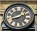
St Thomas Becket's clock
Clock on the wall of St Thomas Becket Church, Chapel-en-le-Frith
Image
Image: © Gerald England
Taken: 16 Sep 2016
0.02 miles
10
St Thomas Becket Church, Chapel-en-le-Frith
There has been a church on this site since 1225 when the woodcutters of the Royal Forest of the Peak received permission to build a chapel in a clearing in the forest. Parts of the church’s foundations, the lower sections of its walls and the piscine probably date from the original building, but the rest of the church is mainly 14th century.
Image: © Neil Theasby
Taken: 18 May 2017
0.02 miles


