IMAGES TAKEN NEAR TO
Quarnford, BUXTON, SK17 0SJ
Introduction
This page details the photographs taken nearby to SK17 0SJ by members of the Geograph project.
The Geograph project started in 2005 with the aim of publishing, organising and preserving representative images for every square kilometre of Great Britain, Ireland and the Isle of Man.

There are currently over 7.5m images from over14,400 individuals and you can help contribute to the project by visiting https://www.geograph.org.uk
Image Map
Images are licensed for reuse under creativecommons.org/licenses/by-sa/2.0
Notes
- Clicking on the map will re-center to the selected point.
- The higher the marker number, the further away the image location is from the centre of the postcode.
Image Listing (5 Images Found)
Images are licensed for reuse under creativecommons.org/licenses/by-sa/2.0
Image
Details
Distance
1
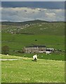
View towards Hollinsclough
From below Sycamore Farm.
Image: © Mick Garratt
Taken: 28 Apr 2012
0.04 miles
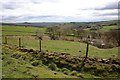
2
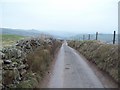
Colshaw
This lane comes to an end shortly ahead with various footpaths streaming off in different directions.
Image: © Jonathan Clitheroe
Taken: 27 Mar 2011
0.11 miles
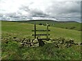
3
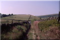
On Colshaw Hill
Walled Green Lane that descends down the South side of the hill to the hamlet of Tenterhill
Image: © Chris Heaton
Taken: 29 Jul 2001
0.13 miles