IMAGES TAKEN NEAR TO
Shawfield, BUXTON, SK17 0NB

Introduction

This page details the photographs taken nearby to Shawfield, SK17 0NB by members of the Geograph project.

The Geograph project started in 2005 with the aim of publishing, organising and preserving representative images for every square kilometre of Great Britain, Ireland and the Isle of Man.

There are currently over 7.5m images from over14,400 individuals and you can help contribute to the project by visiting https://www.geograph.org.uk

Image Map


Images are licensed for reuse under creativecommons.org/licenses/by-sa/2.0
Notes
  • Clicking on the map will re-center to the selected point.
  • The higher the marker number, the further away the image location is from the centre of the postcode.

Image Listing (6 Images Found)

Images are licensed for reuse under creativecommons.org/licenses/by-sa/2.0
Image
Details
Distance
1
Fields towards Smedley Sytch
Grazing land below the moors in the wide valley or bowl of tributaries of Blake Brook.
Image: © Andrew Hill Taken: 11 Jun 2014
0.17 miles
2
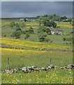
Hillside meadows towards the moors
View up the gentle hillside at buttercup time.
Image: © Andrew Hill Taken: 11 Jun 2014
0.20 miles
3
An attempt to block a footpath
A plastic drum placed at a stile to deter walkers perhaps, or maybe to keep a pet from straying, at a house opposite Sherwood Farm, Shawfield, near Newtown, in Staffordshire.
Image: © Peter Barr Taken: 2 Oct 2010
0.23 miles
4
Lane above Little Fernyford
The lane serves several farms.
Image: © Andrew Hill Taken: 11 Jun 2014
0.23 miles
5
Country lane near Longnor
Image: © Mike Fowkes Taken: 3 Jun 2006
0.24 miles
6
Footpath and view by Little Fernyford
The stone steps of the stile can be seen right of centre - a wall now cuts across the head of an old walled lane. Moorland can be seen rising beyond.
Image: © Andrew Hill Taken: 11 Jun 2014
0.25 miles