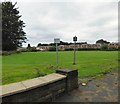
IMAGES TAKEN NEAR TO
Thorncliffe Avenue, DUKINFIELD, SK16 4UD

Introduction

This page details the photographs taken nearby to Thorncliffe Avenue, SK16 4UD by members of the Geograph project.

The Geograph project started in 2005 with the aim of publishing, organising and preserving representative images for every square kilometre of Great Britain, Ireland and the Isle of Man.

There are currently over 7.5m images from over14,400 individuals and you can help contribute to the project by visiting https://www.geograph.org.uk

Image Map


Images are licensed for reuse under creativecommons.org/licenses/by-sa/2.0
Notes
  • Clicking on the map will re-center to the selected point.
  • The higher the marker number, the further away the image location is from the centre of the postcode.

Image Listing (30 Images Found)

Images are licensed for reuse under creativecommons.org/licenses/by-sa/2.0
  • ...
Image
Details
Distance
1
Dewsnap Playing Fields
Image: © Gerald England Taken: 16 Jul 2016
0.06 miles
2
Dukinfield Congregational Church
Although there doesn't seem to be any signage to say so this is the Old Hall site belonging to Dukinfield Congregational Church. http://www.dukinfieldcc.org.uk/page26.html The main church building opened in 1911 lies between Crescent Road and Zetland Street Image
Image: © Gerald England Taken: 16 Jul 2016
0.07 miles
3
White Bridge
Here the A627 from Ashton under Lyne to Hyde does a dog-leg over the railway. Although the official name is Dewsnap Bridge it has been known as the White Bridge ever since the Victorians painted the walls white and they've been kept that way ever since.
Image: © Gerald England Taken: 16 Jul 2016
0.10 miles
4
Fish and Chips
And Chinese Meals to Take Away on King Street.
Image: © Gerald England Taken: 16 Jul 2016
0.10 miles
5
The White Bridge
Bridge where the A627 Ashton-under-Lyne (on the right) to Hyde crosses the Manchester to Glossop railway line in Dukinfield. To the left is Dewsnap Lane.
Image: © Gerald England Taken: 26 Aug 2008
0.10 miles
6
Electricity substation on Kings Road
Image: © Gerald England Taken: 29 Mar 2023
0.12 miles
7
Railway Lines From White Bridge
The extensive catenary masts indicate where former goods loops once stood.
Image: © Peter Whatley Taken: 23 Jan 2010
0.12 miles
8
Newton Moor Iron Works
Commemorative plaque for Daniel Adamson. See also Image and area.
Image: © Roger May Taken: 17 Aug 2005
0.14 miles
9
Site of Former Iron Works
This site was formerly the Newton Moor Iron works.
Image: © Roger May Taken: 17 Aug 2005
0.14 miles
10
The White Bridge
Bridge where the A627 Hyde to Ashton-under-Lyne crosses the Manchester to Glossop railway line in Dukinfield.
Image: © Gerald England Taken: 26 Aug 2008
0.14 miles
  • ...